DENVER (KDVR) — Another round of snow is moving into the state on Monday, and a foot or more is expected in the mountains south of Interstate 70.
It has been a pretty dry winter, thus far for the mountain resorts, even though the snowpack in some areas shows otherwise. Loveland Ski Area has gone 42 days with no more than 3 inches in a 24-hour period. So the resorts are looking forward to this incoming storm.
The Pinpoint Weather Team has forecast the possibility of 3 feet of snow at Wolf Creek.
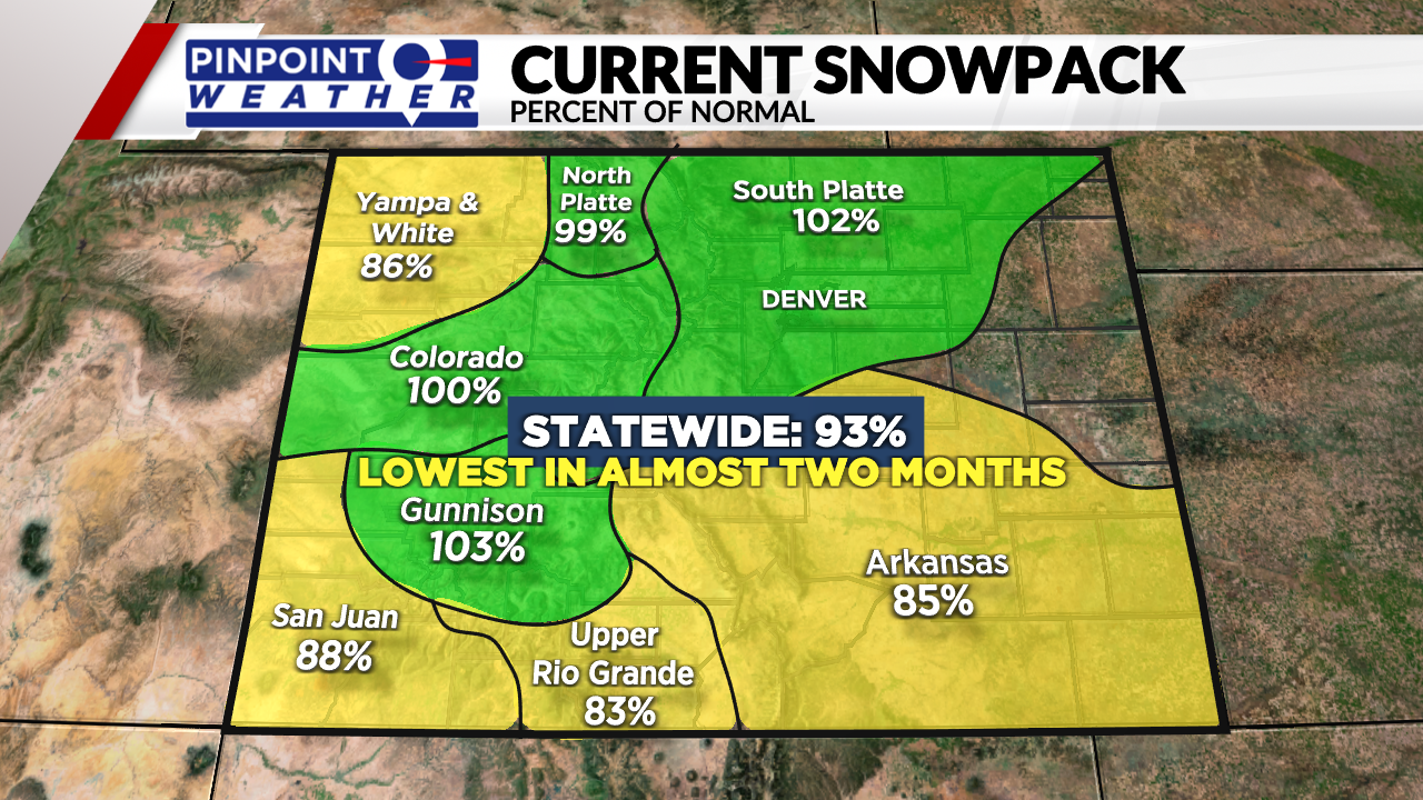
The statewide snowpack (snow water equivalent) dipped to its lowest level in almost two months with the current being 93% of normal. That said, it’s still running about 100% in a few basins. About two months ago the Gunnison and San Juan Basin’s were running 125-150% of normal.

Current resort conditions
As of Friday, the basin and total snow at resorts south of I-70 are:
- Vail: 55-inch base depth, 161 inches so far this season
- Beaver Creek: 55-inch base depth, 148 inches so far this season
- Breckenridge: 52-inch base depth, 175 inches so far this season
- Keystone: 39-inch base depth, 118 inches so far this season
- Crested Butte: 55-inch base depth, 179 inches so far this season
- Wolf Creek: 81-inch midway depth, 257 inches so far this season
- Loveland: 47-inch midmountain depth, 167 inches so far this season
- Aspen: 45-inch base depth
- Aspen Highlands: 68-inch base depth
- Snowmass: 63-inch base depth
- Buttermilk: 34-inch base depth
- Telluride: 47-inch base depth, 146 inches so far this season
Why has it been dry for almost 2 months?
The storm track delivered significant snow to the mountains (near-record amounts in some cases) between Christmas and New Year’s Eve then dried up. For most of January and February, the storm track shifted north. This resulted in about nine fast-moving, minor cold fronts.
These fronts targeted the central and northern mountains with only light snowfall accumulation (moderate in some cases) while leaving western and southwest Colorado abnormally dry.

