DENVER (KDVR) — Another storm system is on the way this weekend that will bring cooler temperatures, rain, snow, and slick roads.
Now that the storm is only a couple of days away, there are more details we know about the timing and totals.
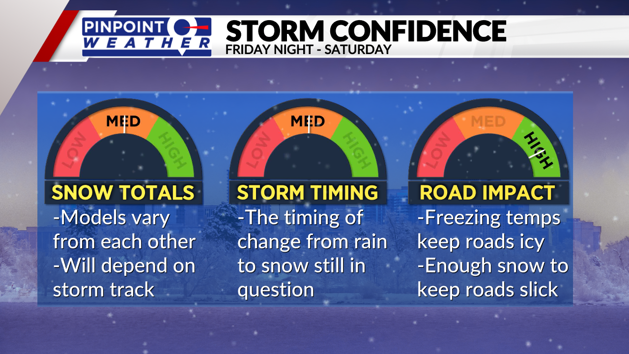
Some computer forecasting models are still in a slight disagreement about the snowfall totals and when the rain will change over to snow on the Front Range. That’s why both totals and timing are at a medium confidence level as of Thursday afternoon.
The road impact is at a high confidence level because we know that there will be enough snow to create slick roads for most late Saturday and into Sunday.

When snow/rain starts and when it ends
Snow will start first in the mountains on Friday and will continue throughout the weekend. The Front Range will see its first precipitation late Friday night in the form of rain.
Rain will change over to snow sometime overnight or Saturday morning. It will all depend on how cold temperatures get Saturday morning. At times, it could be more of a rain/snow mix on the Front Range instead of snow.
Temperatures will be cold enough Saturday night and Sunday to see all of the precipitation fall as snow. There will be on and off showers through Saturday and Sunday with even a few lingering showers possible into Monday before the storm clears.

Anticipated total accumulations
There is not a lot of consistency with computer models on where the heaviest snow will fall and how much any given place will get.
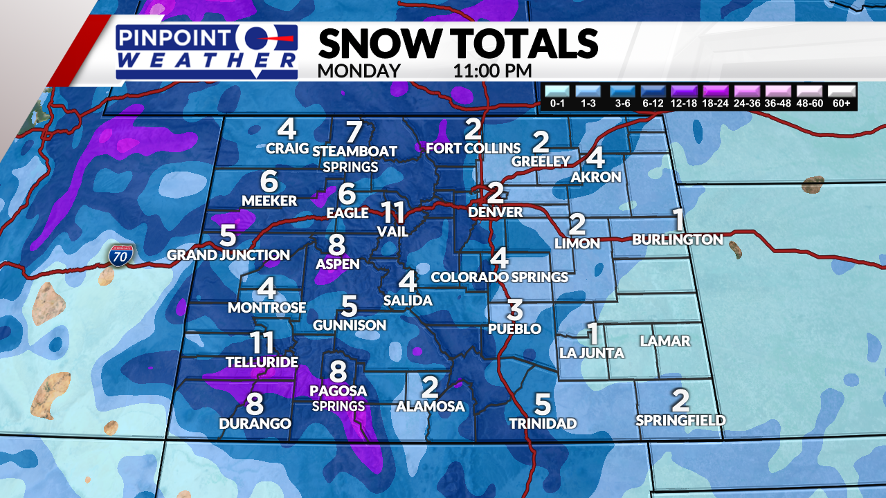
What we know, as of Thursday afternoon, is that the heaviest snow will be west and north of metro Denver. Metro Denver will see about 2 to 5 inches by Monday but it could be more depending on if a heavier band sets up over the city.
The foothills can expect to see about 3 to 7 inches with 3 to 6 inches on the northern Front Range for places like Fort Collins and Loveland.
The mountains will see a range of 6 to 16 inches with this storm and will bring good moisture to the state.
The eastern plains could see a wide variety of totals depending on location. Most places will see 1 to 4 inches of snow but there could be a bullseye of heavier snow northeast of metro Denver due to snow banding. This could bring up to 8 inches in isolated spots.
There will be enough snow for most of the Front Range to see road impacts this weekend and into Monday.
Temperatures will fall to the low 40s on Saturday and will drop to the low 30s for Sunday and Monday.

