This is an archived article and the information in the article may be outdated. Please look at the time stamp on the story to see when it was last updated.
DENVER (KDVR) — La Niña has officially arrived in Colorado. This is a pattern flip from last winter’s El Nino, according to FOX31 Pinpoint Meteorologist Chris Tomer.
So what does this mean for Colorado’s mountains this winter?
Does Meteorologist Chris Tomer agree with the 2020-2021 Farmers’ Almanac Winter Outlook?
Here are the key points:
- Slow start to winter. Consistent snow may not arrive until December
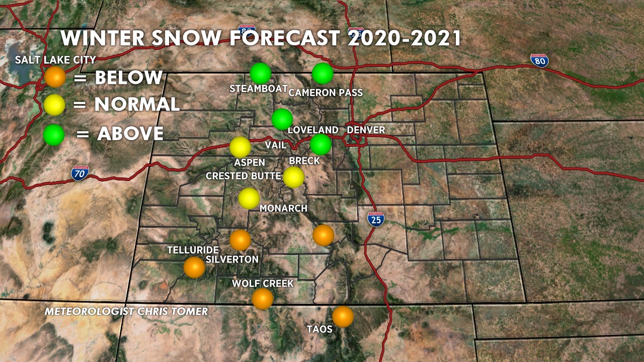
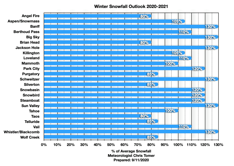
- I-70 and points north are favored most this winter. Resorts like Steamboat, Winter Park, Loveland, Vail Pass backcountry, Rocky Mountain National Park backcountry, Caribou, Indian Peaks, Cameron Pass, and Berthoud Pass
- Southern Mountains will be drier, warmer
- Windier than normal winter for I-70 North
- Somewhat Similar Winter analogs: 2010-2011, 2007-2008
- We could see this Moderately strong La Nina reach “Strong” levels. It might be a long shot. This means the water temps in the equatorial south Pacific cool even more. If this happens it could push us even closer to the analog 2010-2011 Winter pattern
‘Above Average Snowfall’; Farmers’ Almanac says Colorado will see cold, snowy winter

Winter is Coming: Take a look back at last winter, see photos and snow totals


