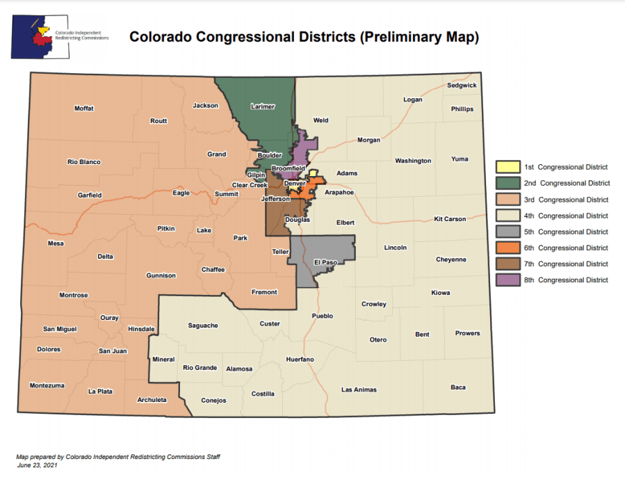
DENVER (KDVR) — It’s a preliminary draft that is subject to change, but Coloradans now have a better idea of which communities will be grouped together for congressional districts.
The Colorado Independent Redistricting Commission released it’s preliminary congressional maps Wednesday.

Colorado will gain an 8th congressional seat, following the 2020 census showing an influx of people moving to the Centennial State. North Carolina, Ohio, Texas and Florida were among the states to also gain a seat in congress, while states like California and New York are losing seats.
Colorado was set to redraw district lines regardless, after voters passed Amendments Y and Z in 2018, which established two independent commissions to draw the electoral maps for state and federal lawmakers every ten years following the census.
The commission will get public input over the next several months, and hold several public hearings on these maps.
According to the Colorado Constitution, new Congressional districts must have: equal populations, be composed of contiguous geographical areas, comply with the federal Voting Rights Act of 1965, preserve whole communities of interest and whole political subdivisions (such as cities and towns) and be as compact as reasonably as possible.

