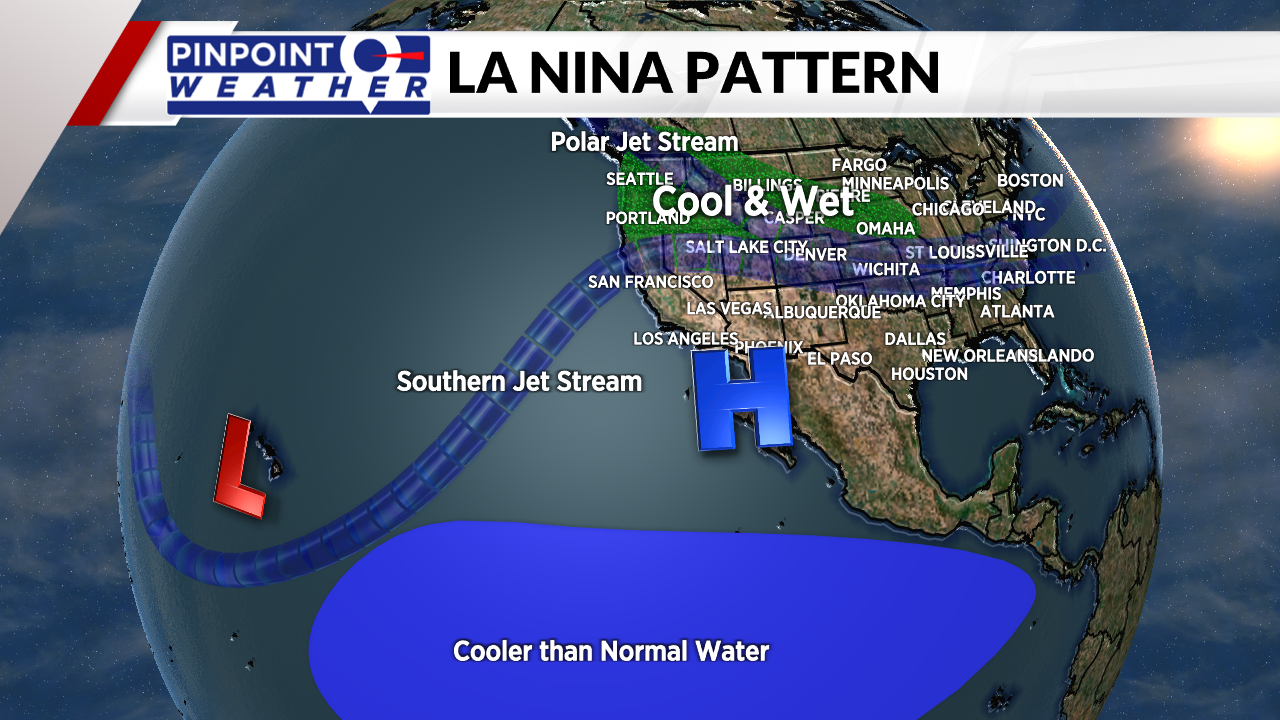
DENVER (KDVR) — What kind of winter will we have in Colorado? As expected, La Nina is here for the second straight fall and winter, but what does that mean for total snowfall?
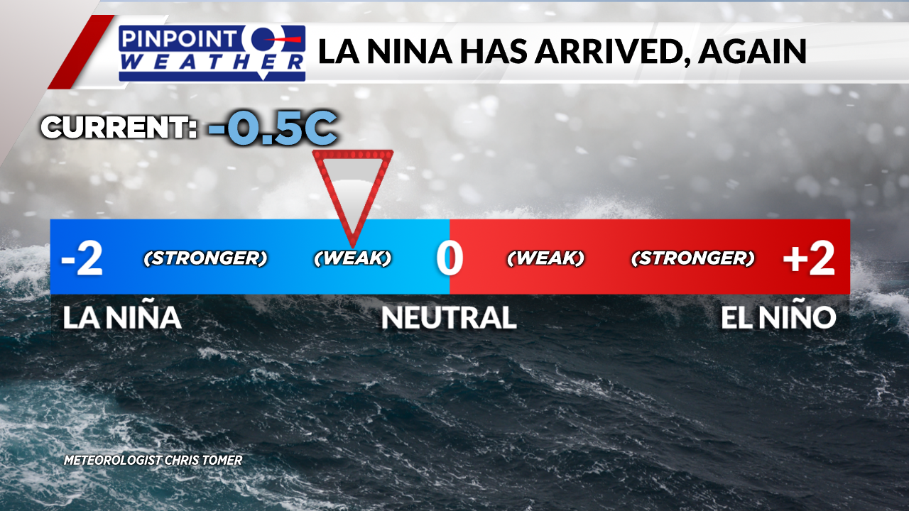
Meteorologist Chris Tomer said sea surface temperatures in the equatorial south Pacific have cooled by -0.5 Celsius, which is the official minimal threshold for La Nina.

The bulk of data suggests that La Nina continues through the entire upcoming winter, with The National Oceanic and Atmospheric Administration giving it an 87% chance of lasting that long.

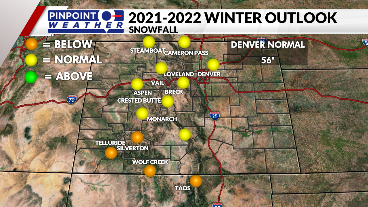
What are the impacts on Colorado? The best chances for normal winter snowfall will occur in the Central and Northern Mountain zones. Expect below-normal snowfall in the Southern Mountains.
In Denver and across the Front Range, Meteorologist Chris Tomer is forecasting normal snowfall, which is about 56 inches.
A few forecast examples:
- Denver/Front Range: Normal Snowfall
- Steamboat: Normal Snowfall
- Loveland: Normal Snowfall
- Breckenridge: Normal Snowfall
- Vail: Normal Snowfall
- Aspen/Snowmass: Normal Snowfall
- Telluride: Below Normal Snowfall
- Wolf Creek: Below Normal Snowfall

The lowest snowfall season total over the last 10 years: 21.8 inches in 2016-2017.
The greatest snowfall season total over the last 10 years: 80.2 inches in 2020-2021. The March 2021 blizzard delivered 27 inches of snow to Denver.
Here’s a look at the snowfall season totals for the last 10 years, according to the National Weather Service:
- 2020-2021: 80.2 inches
- 2019-2020: 57.6 inches
- 2018-2019 48.1 inches
- 2017-2018 25.7 inches
- 2016-2017 21.8 inches
- 2015-2016 72.8 inches
- 2014-2015 57.8 inches
- 2013-2014 38.4 inches
- 2012-2013 78.4 inches
- 2011-2012 55.6 inches
- 2010-2011 22.8 inches

