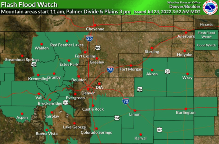
BOULDER COUNTY, Colo. (KDVR) — (Update: 10:20 a.m.) A flash flood watch was enacted by the National Weather Service in Boulder early Sunday morning for multiple areas across Central Colorado, including recent burn scar areas, the Palmer Divide and the eastern plains.
The flash flood watch will be in effect:
- For recent burn scar areas: from 11 a.m. to midnight.
- For the Palmer Divide and east central Colorado: from 3 p.m. to midnight
Original Post
Heavy downpours have prompted several flash flood watches and warnings over burn scar areas in Larimer, Grand, Garfield and Boulder counties.
The Calwood burn scar area between Jamestown and Lyons in Boulder County was issued a flash flood warning by the National Weather Service just before 8 p.m. and will last through 11 p.m. The NWS said a storm that has produced about 0.4″ of rain in 15 minutes moved over the area.

Grand County said Highway 125 is completely closed between Trail Creek and FS Rd 112 due to a mudslide. A flood advisory was issued just before 7 p.m. and is in effect for the East Troublesome burn area until 9:45 p.m.
The Cameron Peak burn scar area in Larimer County is under a flood advisory until 9:45 p.m. The NWS was most concerned for the Crystal Mountain area, where flash flooding killed two people last week.

Earlier Saturday, a flash flood watch was issued for the Grizzly Creek burn scar through Glenwood Canyon.


