DENVER (KDVR) — Colorado has seen earthquakes, although none close to the magnitude of what hit Turkey and Syria early Monday. But just how bad could an earthquake possibly get in the Centennial State?
According to the U.S. Geological Survey, Colorado’s risk for quakes is not even close to the risk in states like California and Alaska.
However, there are regions of Colorado that are more likely to experience these shakes, mainly along the Front Range and down in the San Luis Valley.
What’s the biggest earthquake Colorado has seen?
Here are some fast facts.
The Colorado Geological Survey said the biggest earthquake here happened back in 1882, west of Fort Collins. This was before the proper instruments were available, but based on accounts from the time, they believe that was a magnitude 6.6 quake.
There have been a couple of recent earthquakes in southern Colorado. A 5.3 magnitude quake was registered in Trinidad back in 2011. A smaller earthquake was clocked in the area just last week.
What to know about the Sangre de Cristo fault
But the potential for the biggest earthquakes is likely along what’s called the Sangre de Cristo fault, on the east side of the San Luis Valley.
“We do have faults in Colorado with maximum credible earthquakes above magnitude 7,” said Kyren Bogolub, a seismologist with the Colorado Geological Survey. “The largest maximum credible earthquake for a fault in colorado is 7.5, and that’s on the northern Sangre de Cristo fault in south-central Colorado. That’s not necessarily probable. It’s not expected. But just given the size of the fault, that’s the largest earthquake that we think that fault could produce.”
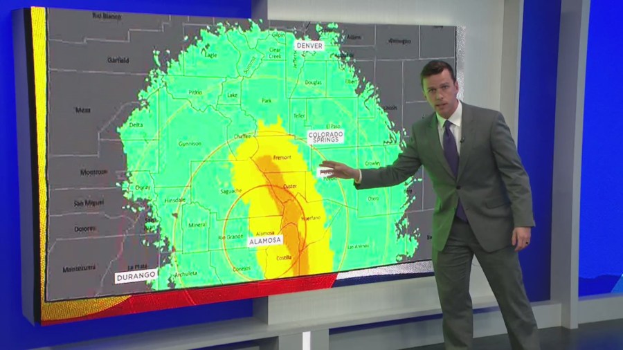
So here’s how bad things could get if Colorado ever saw a 7.5 magnitude earthquake along that fault in our lifetime. Take a look at this image.

The biggest impact would be in Alamosa. It would see building damage.
The quake would ripple up. The yellow areas would be where the earthquake would make things fall off shelves.
In the green, the ground would shake in places like Pueblo and Colorado Springs, and maybe even in Denver and Durango.
