DENVER (KDVR) — It’s a rainy day in Denver, but thankfully most areas of the metro aren’t flood-prone.
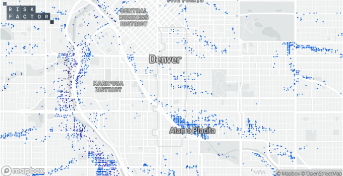
Risk Factor, a natural disaster analytics firm, has a national map tool that charts which properties in the U.S. have a greater than 26% chance of flooding in the next 30 years.
About 5% of the properties in Denver have this risk of flooding, but that proportion is predictably much higher for the neighborhoods directly abutting the Interstate 25 corridor that runs parallel to the South Platte River.

The Denver neighborhoods with the highest density of properties likely to be flooded in the next 30 years are Sun Valley, Valverde, Athmar Park and Auraria.

To see what kind of flood risk your property carries, search Risk Factor’s online tool.
The Alamo Placita area northwest of the Denver Country Club is the other area with the highest concentration of properties likely to flood.
