DENVER (KDVR) — After a dry April, weather patterns have changed in Colorado with a wet first few days of May.
The mountains and higher elevations picked up snow with this storm system while most of the lower elevations on the Front Range and plains have seen rainfall.
One of the biggest totals in the mountains is up in the Winter Park area where 11 inches of snow has fallen in 24 hours. Skiers can enjoy fresh powder at Mary Jane which is still open.

Other areas picked up anywhere from 1 to 8 inches of snowfall bringing a great late spring storm to the mountains. This moisture will help decrease fire danger, at least for the time being.
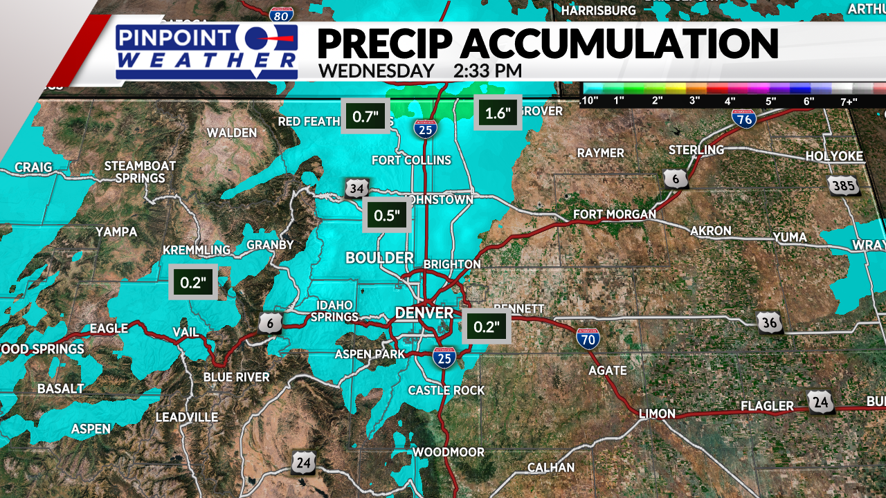
The lower elevations picked up some rainfall accumulation that ranged from a few tenths of an inch up to an inch and a half.
The areas in blue on the map saw under an inch of rain while the areas in green, up across the Colorado/Wyoming state line, show where accumulation was over an inch.

Places near Wellington and Cheyenne picked up about 1.6 inches of rain in the last 24 hours.
More rain and snow are expected to fall across Colorado Wednesday night into early Thursday before a stretch of dry weather returns.

