Map: Oil and gas wells in Colorado
Map: Oil and gas wells in Colorado
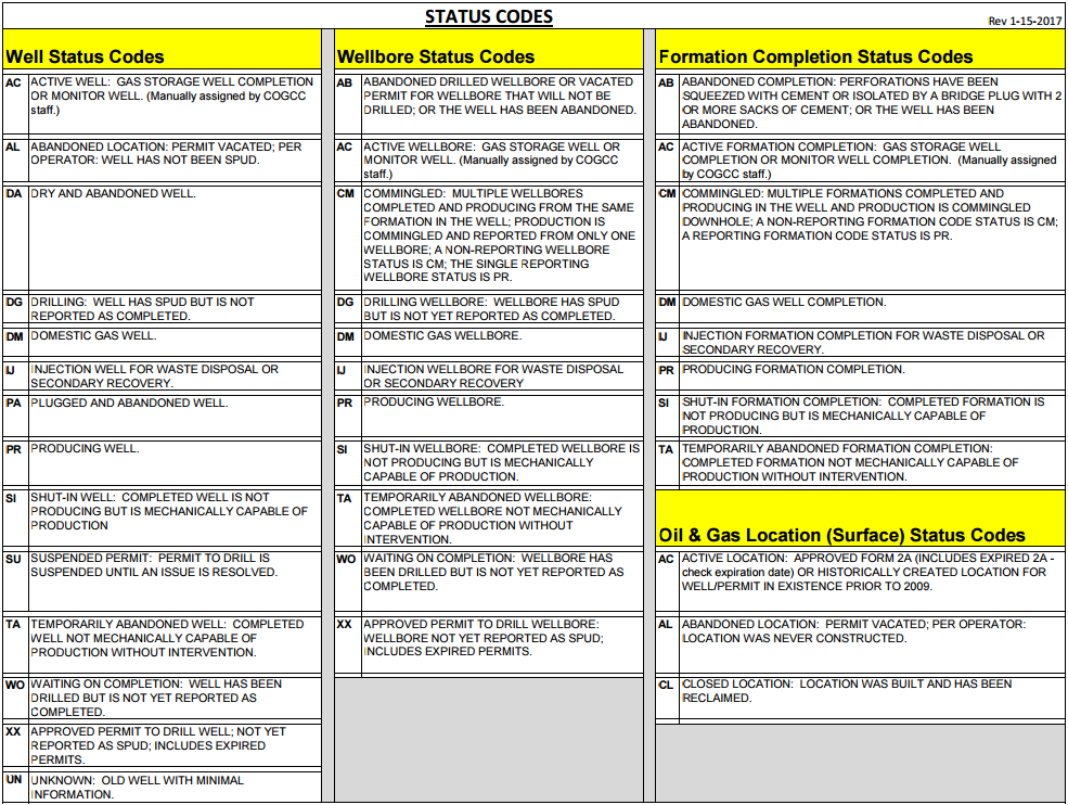
This map shows the location and status of every oil and gas well – active and plugged – in Colorado that the state has data on, including active and expired permits. Not all wells are included in the state’s data. Data from the Colorado Oil & Gas Conservation Commission as of May 1, 2017.
[protected-iframe id=”c07815cd5d5f9b88106edd2abb2ddf72-29290497-96747295″ info=”https://fusiontables.google.com/embedviz?q=select+col23+from+1HN-0NMjwbzRcFdRXryVTY7Yv4kvy7-SXYCuXT4aI&viz=MAP&h=false&lat=38.99704339584138&lng=-105.59762358544924&t=1&z=7&l=col23&y=2&tmplt=2&hml=TWO_COL_LAT_LNG” width=”100%” height=”600″ scrolling=”no”]
Map Key

Definitions

Los Angaras
63°F Sunny Feels like 62°- Wind
- 13 mph SW
- Humidity
- 34%
- Sunrise
- Sunset
Tonight
48°F
Clear skies. Low 48F. Winds light and variable.
- Wind
- 4 mph E
- Precip
- 10%
- Sunset
- Moon Phase
- Waning Gibbous