DENVER (KDVR) — Wednesday evening will be pleasant for Denver’s weather, while snow is expected to return to the Colorado mountains through the day on Thursday. The next weather change is expected for the metro area early next week.
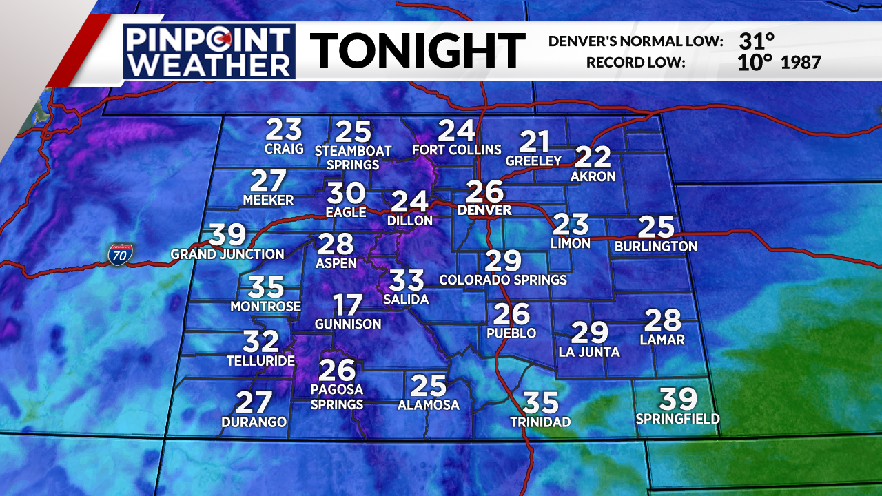
Weather tonight: Few clouds, cold again
There will be passing clouds during the overnight hours across most of Colorado. It’ll be breezy with winds coming out of the southwest up to 15 mph.
Temperatures will be cold with lots of below-freezing readings, including low- to mid-20 across metro Denver and the Front Range.
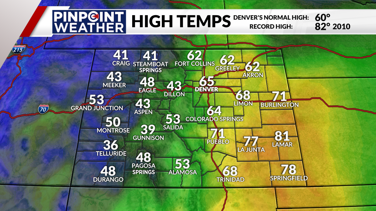
Weather tomorrow: Windy, warmer with fire danger
Ahead of an approaching storm from the west, the wind will continue out of the southwest and turn gusty with speeds from 15-30 mph at times. That warm wind will push afternoon highs across the eastern half of the state into the 60s, 70s and 80s.
There will be high fire danger due to the wind, especially across the southeastern plains.
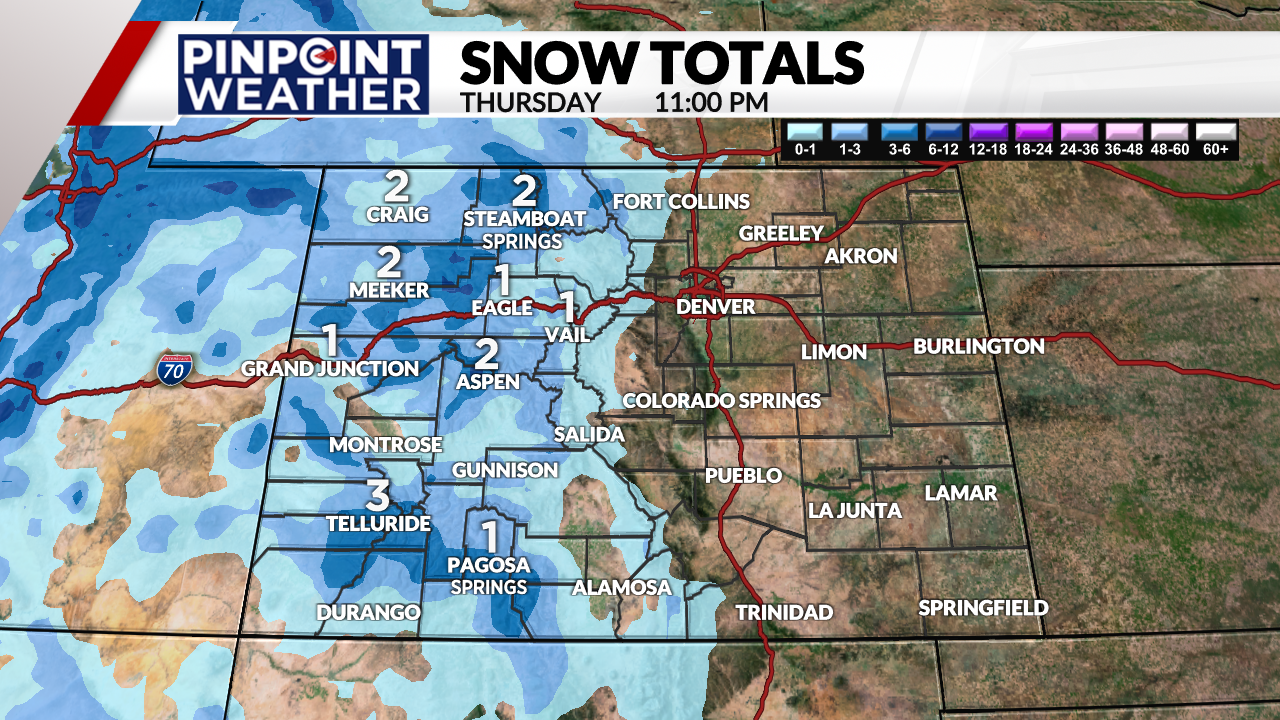
Meanwhile, several inches of accumulation is possible in the mountains. There could also be slick travel, especially over the higher mountain passes. Pinpoint Weather, Colorado’s Most Accurate Forecast, has more snow possible in the high country on Friday.
Looking ahead: Warm before rain, snow return
Enjoy a very warm weekend with plenty of sunshine and lighter winds as the calendar turns to April. There is the possibility that on Sunday, some metro communities could reach the 70s. The warm readings will stick around to start next week before the next change arrives.
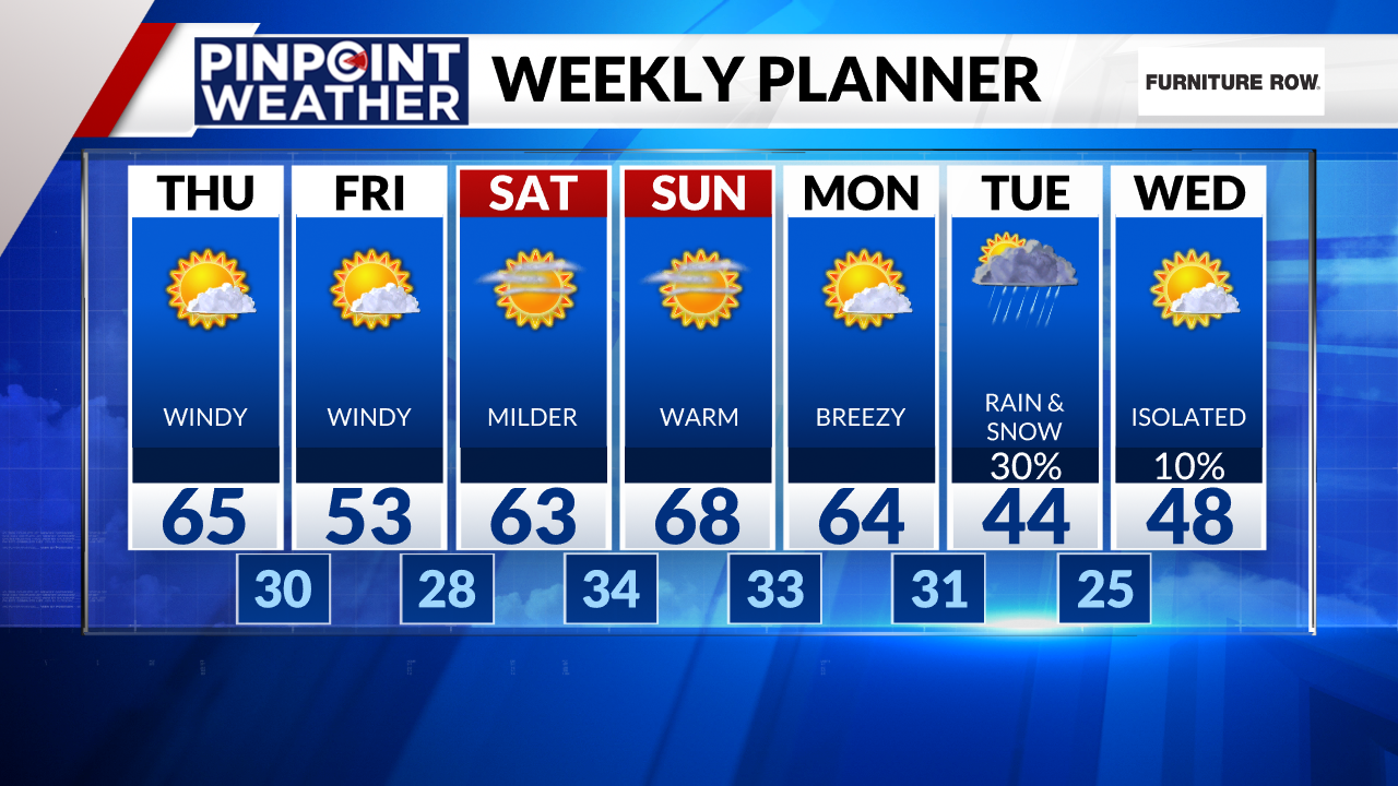
A cold front will arrive late on Monday night. Temperatures will dip back into the 40s for the middle of next week. There will also be some rain and snow showers as the front passes on Tuesday.
Right now, the possibility of accumulating snow is on the low side. Any snow that does fall will quickly melt on roads given the warm days ahead of the storm.

