DENVER (KDVR) — The mild temperatures and pleasant sunshine will be sticking around in Denver weather for a few more days. The Pinpoint Weather team is closely watching a storm system that will have us back to snow late Tuesday into Wednesday in Colorado’s Most Accurate Forecast.

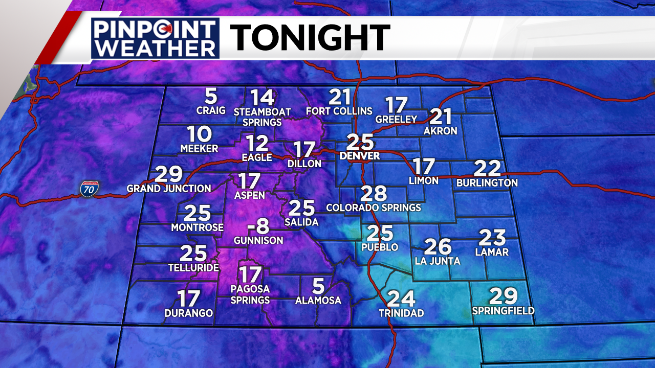
Weather tonight: Cloudy and cold
Clouds have been streaming across Colorado Saturday and most of those clouds will stick around for the overnight hours. The wind will be light in most places. Temperatures will be cold, but not as cold as the last few nights.

Weather tomorrow: Another mild day to enjoy
Your Sunday will start off with clouds along the Front Range and in metro Denver. Skies will slowly clear by late in the afternoon. It will be a pleasant day with light wind across the region. Our average high in Denver at this time of year is 45 degrees. Our afternoon readings on Sunday will exceed that, reaching the upper 40s to low 50s. It may not be as warm as the 60s we saw on Saturday, but it’ll still be mild.

Looking ahead: Snow and cold returns
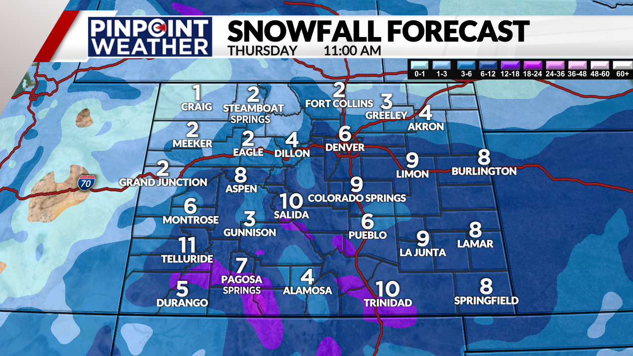
The Pinpoint Weather team continues to track a storm that will move from the west coast across Arizona and New Mexico before lifting into Texas. This southern track is favorable for snow across Colorado. Along the Front Range and in metro Denver this could produce an upslope event that will have the deepest snow totals from I-70 to the south and west. Right now this image is what could be POSSIBLE totals:

However, the exact storm track will determine where the heaviest snow will fall. There has been a slight southerly shift in that track in the last 24 hours. The storm is still 3+ days away. It is not uncommon for there to be flucuations in both track and totals. So, we will continue to anaylze the data each day and post our latest forecast here.

