DENVER (KDVR) — Denver’s weather will bring big travel impacts to some areas Monday night and Tuesday with an incoming snowstorm that will bring strong winds, cold temperatures and blizzard conditions to the northeast plains.
This has been a tough storm to forecast. There are still a lot of uncertainties as to who will see the big totals, and forecast models are still inconsistent. If you have to travel in Colorado Monday night or Tuesday, make sure to stay up to date with the forecast and how things are developing.
With this storm, the outcome will be a matter of miles east of Interstate 25 where the big totals will end up. If the storm shifts just a few miles farther west, it could mean bigger totals for the east side of metro Denver, including Denver International Airport and Aurora.

Weather tonight: Snow starts late in Denver
Colorado’s mountains will be the first to see snow from the storm on Monday with scattered showers throughout the afternoon and evening. The snow will reach the Front Range and plains after 8 p.m. Monday night.
Snow showers will continue to fall on the Front Range and plains overnight and into Tuesday morning before ending Tuesday afternoon.
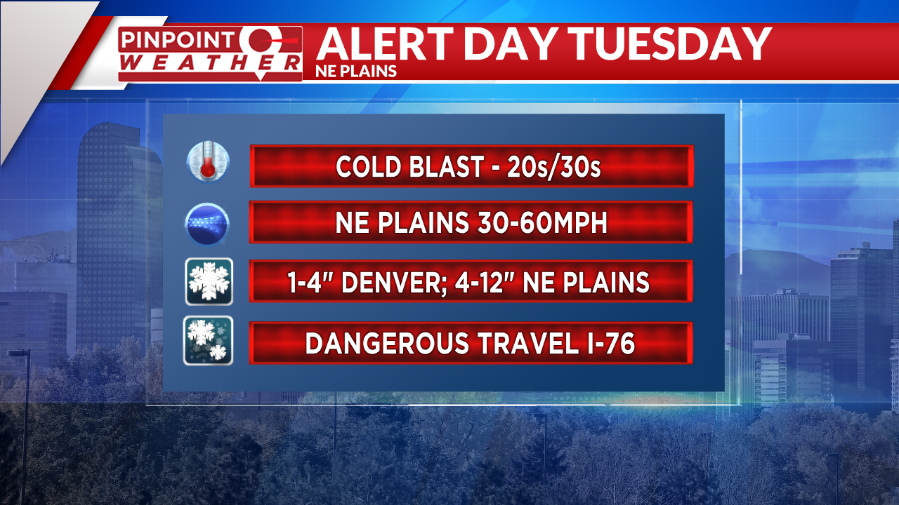
Winds will increase Monday evening after sunset with gusts up to 40 mph overnight on the Front Range and up to 60 mph on the Eastern Plains.
Temperatures will drop to the 20s in Denver on Tuesday morning. The commute will be slick, slow and windy.
Weather tomorrow: Blizzard warning, low visibility
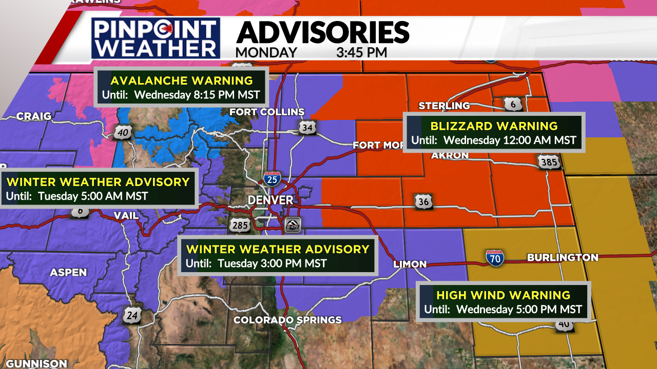
Many warnings and advisories have been issued across the state. In the mountains, a winter weather advisory, a winter storm warning in the northern mountains and avalanche warnings are in place.
On the Front Range, a winter weather advisory will start late Monday night and continue through 3 p.m. Tuesday.
On the plains, where the biggest travel impacts in the state are expected, a blizzard warning is in place from midnight Monday night to midnight on Tuesday. This is where visibility will be very low with strong winds and heavy snow. It is likely that highways will close in parts of northeastern Colorado.

As mentioned above, snowfall totals are still in question for areas east of Interstate 25. The dark blue areas showing higher totals could shift east or west, which would impact where the 3-6 inches totals end up.
As of Monday afternoon, the forecast is:
- Metro Denver/Front Range: 1-4 inches
- Foothills: 0.5-2 inches
- Northeast plains: 4-12 inches
- Mountains: 4-16 inches

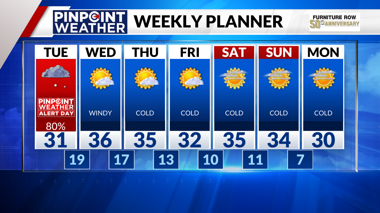
High temperatures will hit the 30s Tuesday afternoon along the Front Range.
Looking ahead: Dry, cold week
The Front Range and plains will dry out on Wednesday with lingering snow showers in the mountains. Winds will still be gusty with highs reaching the mid-30s in Denver.

The rest of the week will be cold and dry in Denver.

