DENVER (KDVR) — A spring snowstorm is on the way to Colorado. The Pinpoint Weather Team has issued a Pinpoint Weather Alert Day for all day Friday and the morning on Saturday.
Highs will be close to 90 degrees on Thursday before the cold front arrives early Friday morning. Temperatures will drop into the 40s.
Snow/rain will start in northern Colorado and the central and northern mountains first. Then, around 12 p.m., snow/rain will arrive in Denver.
Rain/snow is likely in Denver through the evening rush hour, and it will change to all snow Friday night before clearing out Saturday morning.
We are forecasting two freezes: Friday night into Saturday morning and Saturday night into Sunday morning.
How much snow will accumulate?
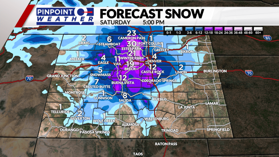
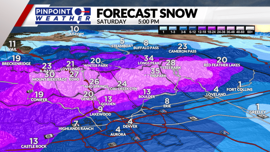
Meteorologist Chris Tomer says total snow accumulations will vary, but the biggest totals will come from above 6,000 feet. That includes the Foothills, some western suburbs, mountains, and Palmer Divide. That’s where 1-2 feet of accumulation is possible.
Forecast accumulations:
- Denver 1-4 inches
- Foothills 1-2 feet
- Palmer Divide: 6-12 inches
- Eastern Plains 1-3 inches
- Northern Colorado 1-4 inches
- High Mountains 1-2 feet on the Divide with less west


Expect an 80% melt rate for Denver and many places along the I-25 Corridor, meaning that only 20% of the snow that falls will stick and accumulate.
Be sure to download the free Pinpoint Weather App to stay up-to-date with the newest data as it comes in.
