DENVER (KDVR) — More clouds and warmer temperatures return for Sunday with the highs climbing close to the 80-degree mark, making record warmth likely Sunday afternoon.
The current record high for Sunday is 78 degrees, set in 1988.
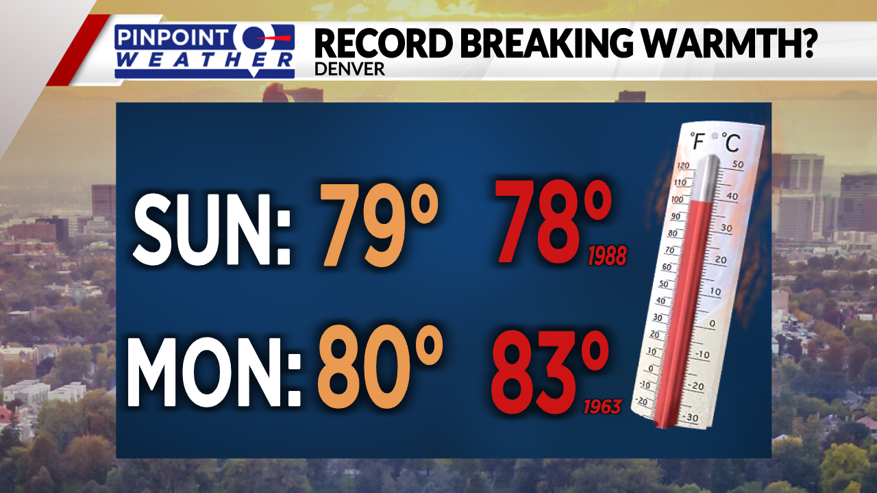
The warm weather sticks around for the start of the workweek with highs in the lower 80s and mostly sunny skies.
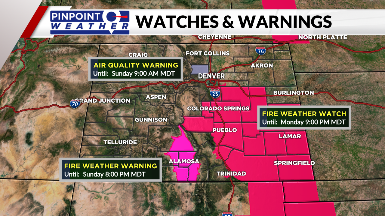
With the unseasonably warm temps and gusty winds, we do have fire weather danger through Monday.
Tuesday will be mild as highs reach the lower 60s with building clouds. Rain moves into the metro area in the late afternoon and can switch to snow overnight. That system lingers and can provide light snow and rain showers through the first half of Wednesday. Temperatures in the middle of the week will be in the lower 50s.
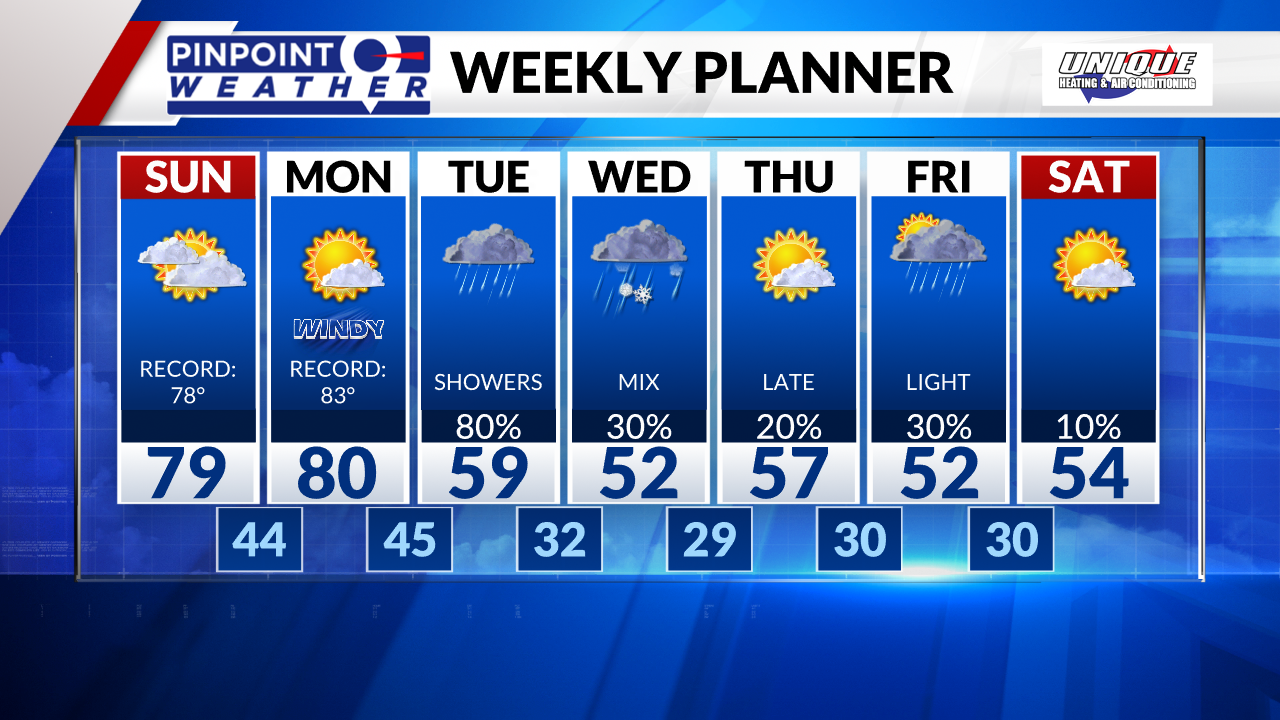
Clouds linger on Thursday with highs staying below average in the 50s. Clouds build back across the area on Friday as rain and snow push in later in the day, that can stick around overnight and into early Saturday. Saturday sees clearing skies and highs in the middle 50s.

