This is an archived article and the information in the article may be outdated. Please look at the time stamp on the story to see when it was last updated.
DENVER (KDVR) — Snow came to an end across Colorado early Thursday morning. Across the Front Range, most saw a range of snow from 4 to 8 inches. Some areas saw heavier pockets of snowfall.
Here is a look at preliminary snow totals from the National Weather Service as of 9 a.m. on Thursday.
- Arvada: 6 inches
- Aspen Park: 7 inches
- Aurora: 5.1 inches
- Berthoud Pass: 4.8 inches
- Beulah: 6 inches
- Boulder: 6 inches
- Broomfield: 5.5 inches
- Brookvale: 5 inches
- Calhan: 4 inches
- Cameron Pass: 3.2 inches
- Castle Rock: 3 inches
- Conifer: 7 inches
- Crescent Village: 7 inches
- Denver International Airport: 5 inches
- Downtown Denver: 5 inches
- Echo Lake: 3.2 inches
- Edgewater: 7 inches
- Englewood: 6 inches
- Erie: 2.7 inches
- Estes Park: 3 inches
- Evergreen: 4.4 inches
- Fort Collins: 4 inches
- Genesee: 9 inches
- Glendevey: 3.2 inches
- Grand Lake: 3.2 inches
- Grand Mesa National Forest: 4 inches
- Greeley: 2.6 inches
- Golden: 7.1 inches
- Highlands Ranch: 3.8 inches
- La Junta: 3 inches
- Lakewood: 5.5 inches
- Leyden: 2.6 inches
- Longmont: 6 inch
- Louisville: 5.4 inches
- Loveland: 2 inches
- Marshall: 5.4 inches
- Monument: 4 inches
- Morrison: 4 inches
- Mount Audubon: 8 inches
- Nederland: 7 inches
- Northglenn: 3.6 inches
- Palmer Lake: 7 inches
- Parker: 3 inches
- Pinecliffe: 8.2 inches
- Pinegree Park: 3.2 inches
- Pleasant View: 4 inches
- Poudre: 4 inches
- Silverthorne: 3.8 inches
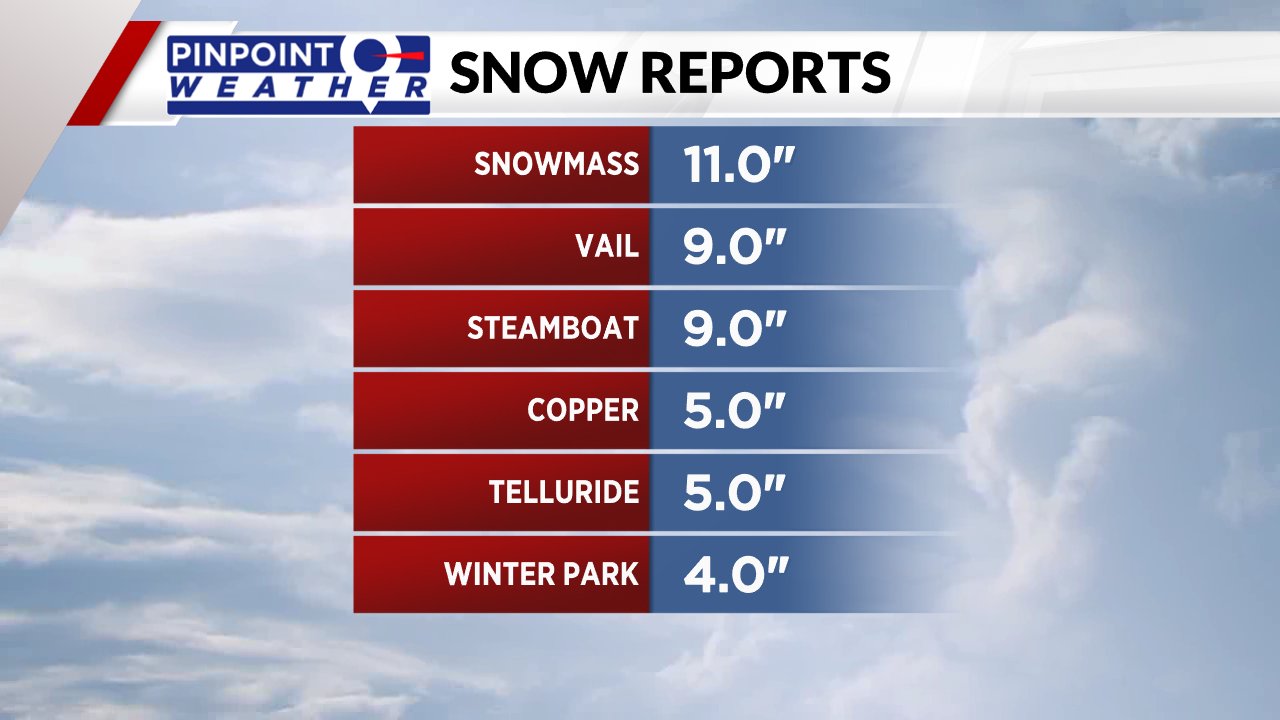
- Snowmass: 11 inches
- Superior: 5.5 inches
- Thornton: 3.6 inches
- Timnath: 4 inches
- Ward: 4.8 inches
- Westminster: 4.4 inches
- Wetmore: 8 inches
- Wheat Ridge: 4.6 inches

Don’t see your town or city listed? This list includes everything reported to the NWS through its own measurements and other sources reported to the agency. More locations may be added over time. Check back for updates.

