DENVER (KDVR) — The snow pattern has shifted from the mountains to the Front Range over the past few weeks. Fall and the start of winter were wettest in the mountains, but in January and February, the tables have turned.
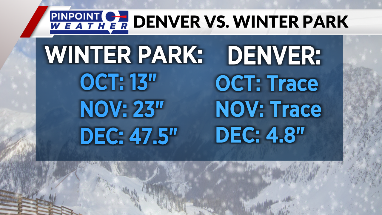
If we compare Winter Park to Denver, Winter Park saw about 6 feet of snow from November through December. Meanwhile, Denver was struggling to see its first measurable snowfall of the season.
Denver finally saw 0.3 inches of snow on Dec. 10 and another 4.5 inches on New Year’s Eve to finish out the month below average.

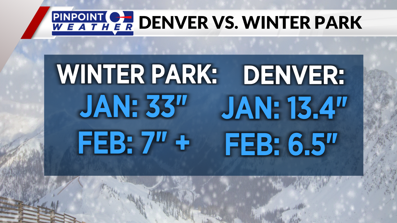
The beginning of January was still snowy for the mountains and things slowed down a bit there. Thanks to the beginning of the month, Winter Park saw 33 inches in January.
The snow pattern finally arrived in Denver in January, bringing snowstorm after snowstorm. The month ended with 13.4 inches of snow, ranking as the 13th-snowiest January on record.

February has been fairly dry for the mountains with only a few inches of snow from each storm. So far, Denver has seen 6.5 inches of snow, which is only about an inch behind the monthly average of 7.7 inches.
With another snowstorm on the way on Wednesday, Denver will likely surpass the monthly average only 16 days into the month.

