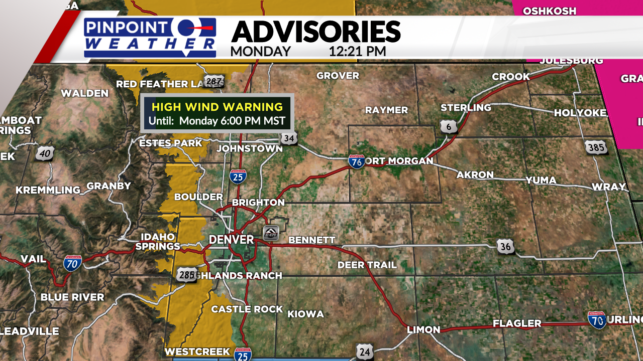
DENVER (KDVR) — Monday will be the last mild day before cooler weather and snowfall move in. There will be strong winds in the foothills through Monday evening.
After a high wind warning was issued Monday for the foothills, with wind gusts up to 80 mph possible, there will be less wind on Tuesday. Wednesday is a Pinpoint Weather Alert Day because of impactful snow.
Snow showers will start first in the mountains midday Tuesday and will slowly shift east by Tuesday afternoon. There could be snow showers into the foothills and west side of Denver by the evening with more building in overnight.

Roads will likely just be wet for the Tuesday evening drive thanks to warm pavement temperatures and the snow starting later in the afternoon.
Snow showers will be on and off Tuesday night into Wednesday morning with more showers expected Wednesday afternoon. The snow will come to an end by Wednesday night.
Totals will range from 2 to 4 inches across metro Denver with 3 to 7 on the Palmer Divide and 4 to 8 inches into the foothills. Western Boulder and Larimer Counties will be the bullseye for some of the biggest totals.
The eastern mountains will see higher totals of 5 to 10 inches with lower amounts as you head west.
Wednesday will see the biggest commute impacts with this storm. Temperatures will drop below zero after the snow clears early Thursday morning.
Dry weather will return for the rest of the week with slowly warming conditions into the weekend. High temperatures on Saturday and Sunday will hit the 40s.

