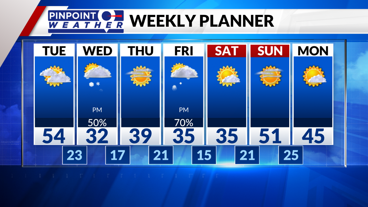
DENVER (KDVR) — We’re forecasting cloudy skies on Tuesday with warm highs in the mid 50s in Denver. The mountains stay partly to mostly cloudy, in the 20s and 30s.
Two cold fronts are lined up for Colorado. The first front arrives on Wednesday, a Pinpoint Weather Alert Day, with a 25-degree temperature drop. Front Range highs are predicted to be in the low 30s. Freezing drizzle early Wednesday morning could lead to slick spots during the morning commutes, especially on driveways and sidewalks.
There will also be on-and-off snow Wednesday, although less than half an inch of accumulation is expected.
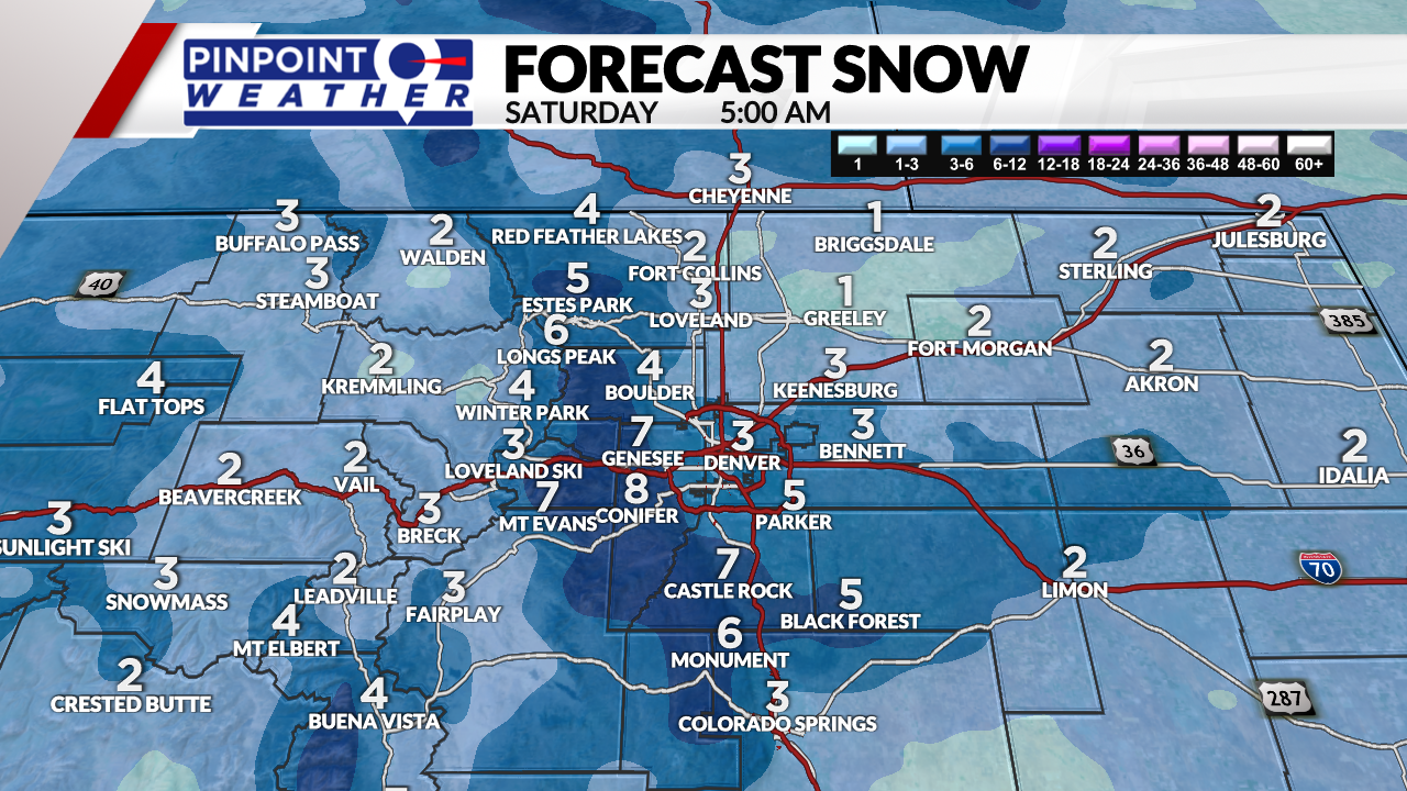
The second front arrives on Friday with temperatures in the 30s and afternoon and evening snow chances. One to 3 inches across the Front Range, up to 6 inches in the foothills and ski areas.
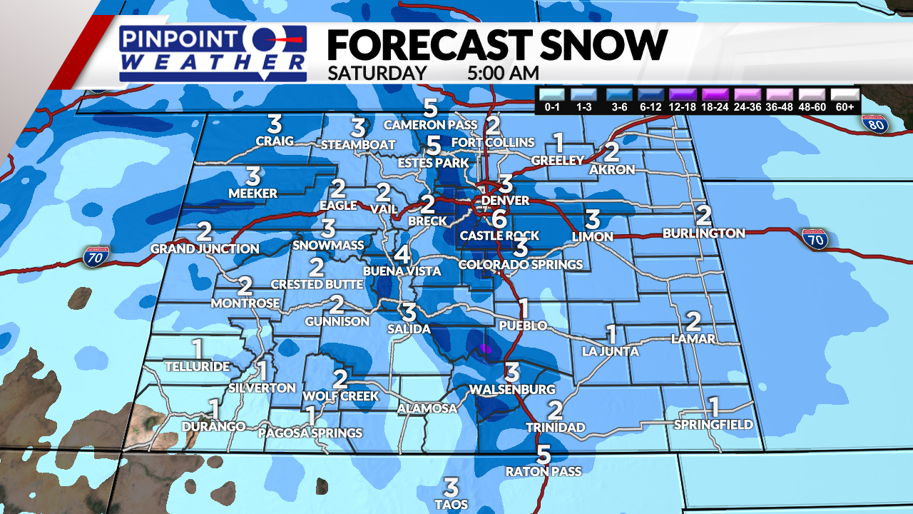
The snow will taper off overnight Friday and into early Saturday morning.
A drier Saturday and Sunday are expected with temperatures in the 40s.

