DENVER (KDVR) — We are forecasting partly to mostly cloudy skies on Tuesday in Denver, Boulder, Loveland and Fort Collins with highs around 45 degrees.
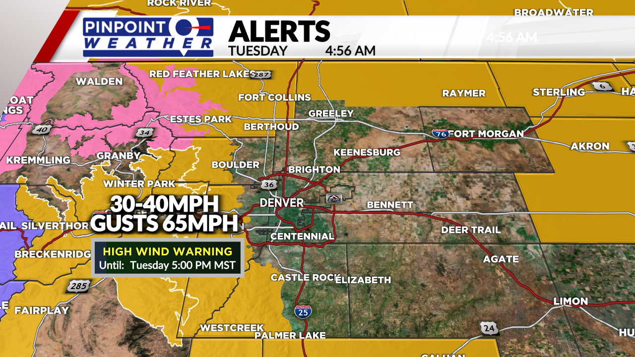
Gusty wind is likely today in the Foothills, western suburbs, Palmer Divide, and Northeastern Plains through 5 p.m. tonight. High Wind Warnings are in effect. Expect gusts between 30-40 mph with occasional gusts to 65 mph.
There will be strong wind for the Divide and Foothills on Wednesday, and especially on Thursday. Wind gusts on Thursday could reach 80 mph.
The mountains start dry, then snow with a cold front hits Tuesday evening. This cold front will mainly impact the Central and Northern Mountain zones. Highs will be in the 20s.
Snow continues in the mountains Wednesday before tapering off on Thursday afternoon, then it returns on Saturday.
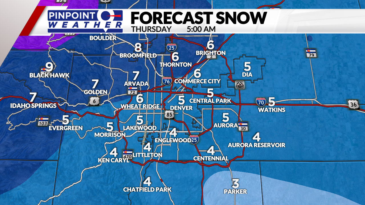
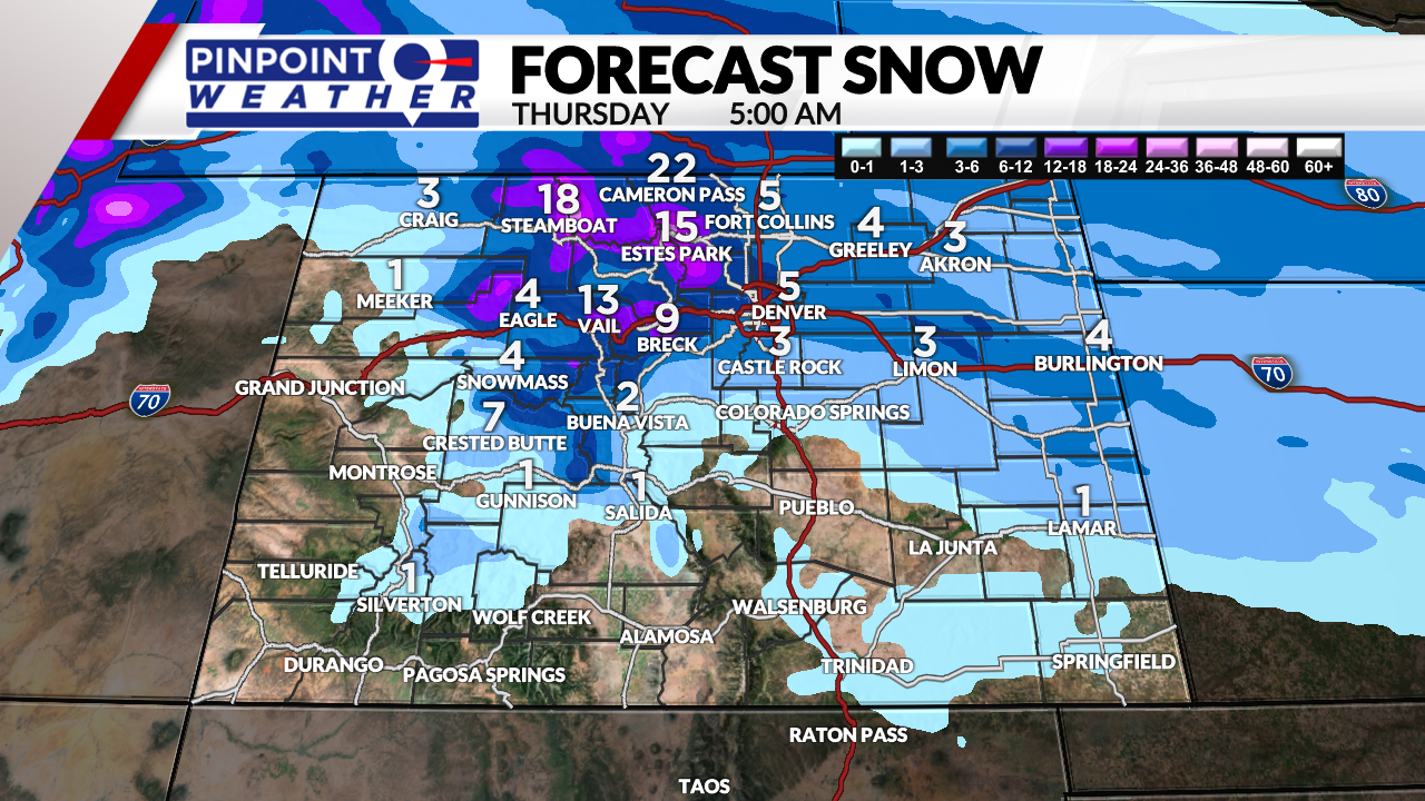
Snow hits Denver and the Front Range between 5 p.m. Wednesday and 3 a.m. Thursday. The bullseye for biggest totals is the Northern Mountains.
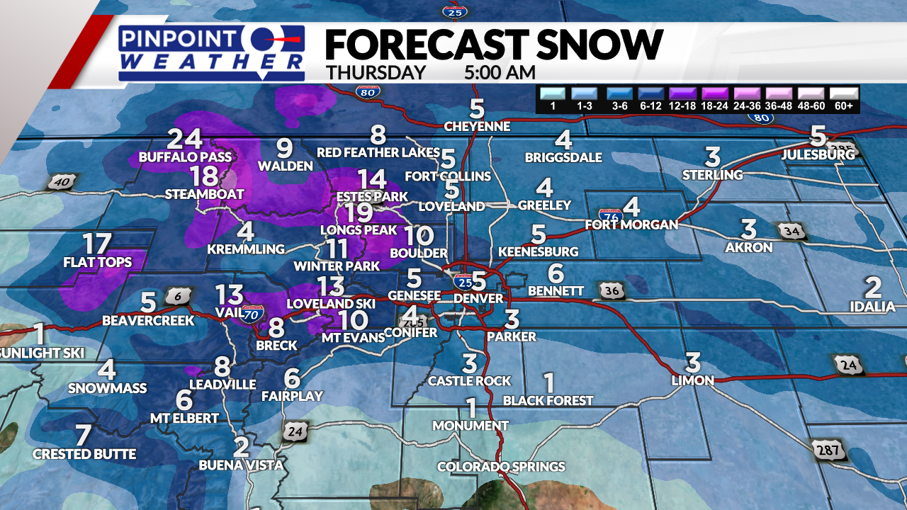
- 1-5 inches Metro Denver
- 2-5 inches Northern Colorado
- 1-3 inches Palmer Divide
- 4-8 inches Western Suburbs
- 4-10 inches Foothills
- 1-2 feet Northern Mountains
- 6-12 inches Central Mountains
Low temperatures in Denver will drop to zero degrees Wednesday night into Thursday morning.
Conditions will be dry across the state on Friday.
The next storm system arrives on Saturday with a slight chance (20%) of snow (or rain/snow) in Denver.

The mountains could see another 1-4 inches of snowfall on Saturday.
Conditions will be drier on Sunday.

