DENVER (KDVR) — I’m forecasting sunny skies and mid-30s on Wednesday.
Another small wave of low pressure crosses the mountains on Wednesday with 1-4 inches of snow accumulation at most ski areas and heavier accumulation at the Western Slope and San Juan ski areas.
Then a possible merger of two storm systems occurs between Thursday night and Saturday morning across Utah, Colorado and New Mexico.
If this merger occurs, then a stronger storm system emerges for Colorado. We’re forecasting at least a partial merger.
Denver’s snow window is 5 p.m. Friday through noon Saturday.
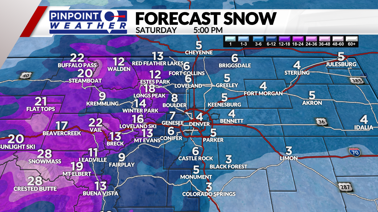
Snow forecast New Year’s Eve into New Year’s Day:
- Western Slope ski areas: 1-2 feet
- East of Vail Pass, Summit County, Tunnel: 8-16 inches
- Foothills and west Boulder: 6-12 inches
- Denver and I-25 Corridor: 1-5 inches
- Palmer Divide: 3-6 inches
It will be much colder on New Year’s Day, with Front Range highs in the teens with lows near zero. Foothill and mountain temps will be in the single digits.
It will be drier and sunny on Sunday with temperatures in the 40s.