DENVER (KDVR) — A tornado watch has been issued by the National Weather Service for areas along the border of Colorado and Kansas.

The first part of a two-part storm system arrives today in Colorado’s mountains. There will be snow above 8,000 feet and gusty wind at 40-80 mph on the high peaks. Expect a total of 2-6 inches of accumulation by Wednesday morning.
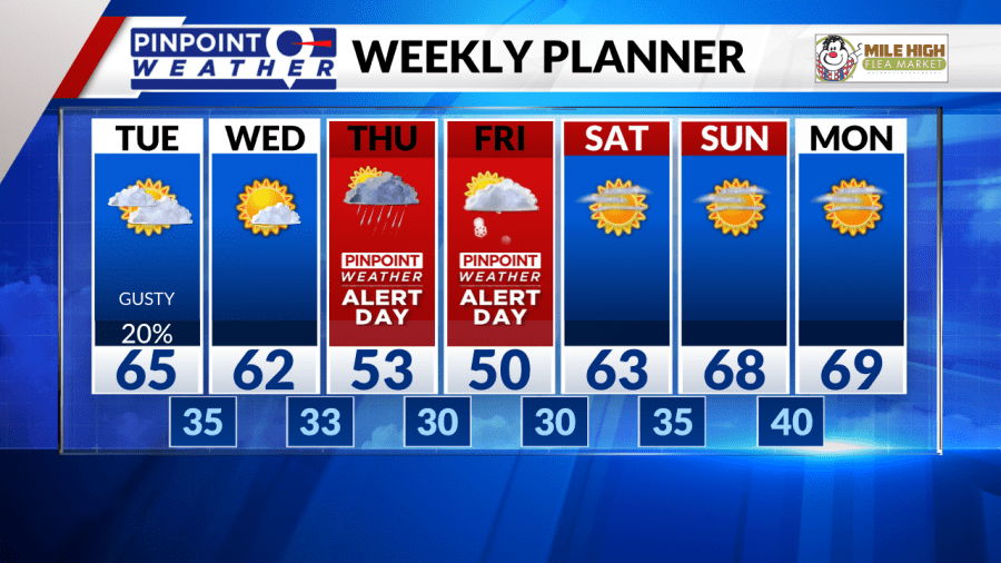
In Denver, there will be gusty winds today at 20-45 mph with partly to mostly cloudy skies. There will also be a 20% chance of afternoon showers/t-storms with Highs around 65 degrees.
We get a break in the action on Wednesday.
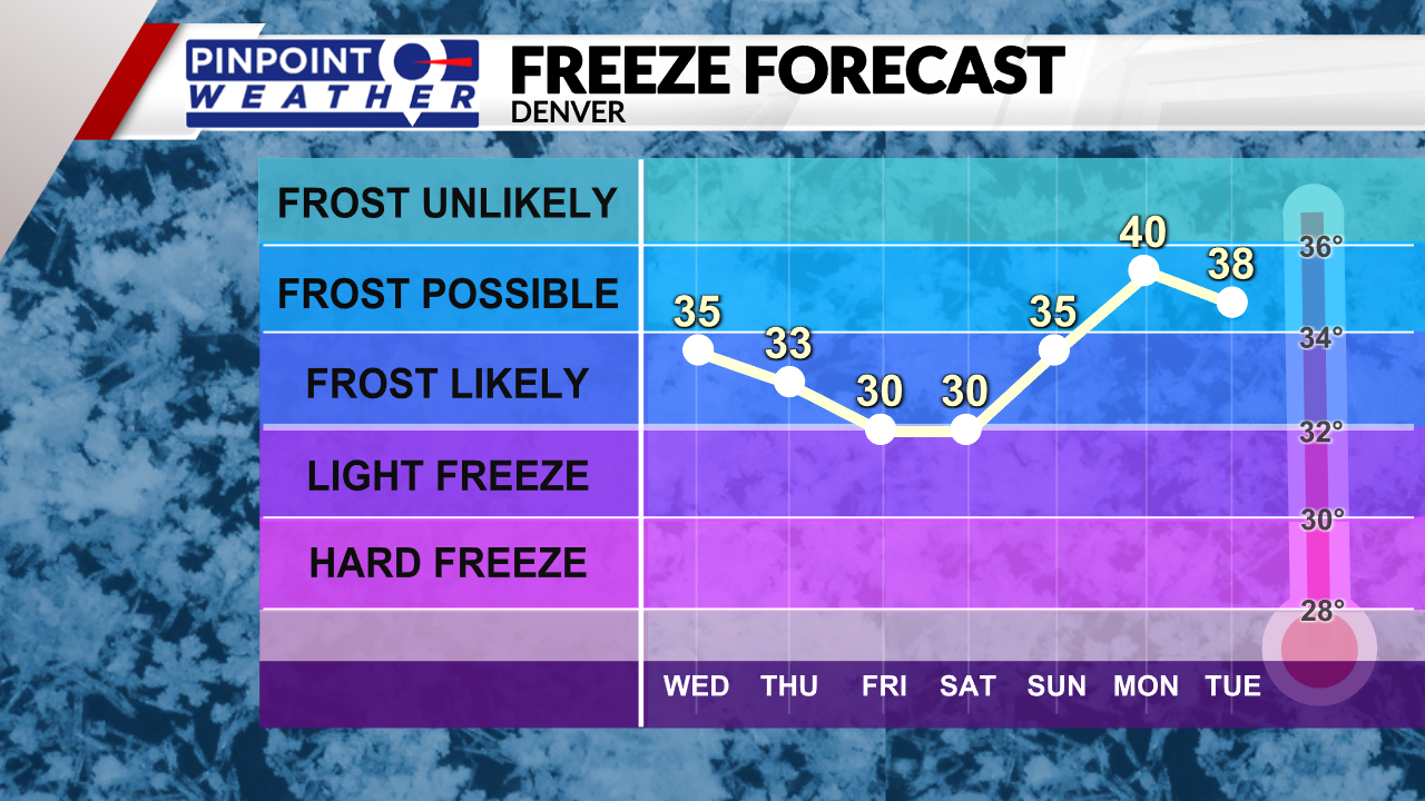
Part two of the storm system arrives with a rain/snow mix in Denver Thursday night into early Friday morning. Expect one inch or less of snow accumulation on the grass, roofs, and lots of melting. Highs on Thursday fall through the 50s into the 40s and 30s. Highs on Friday will be near 50 degrees.
We are forecasting an additional 2-6 inches of snow in the mountains. 1-3 inches in the Foothills and Palmer Divide as snow levels fall to 6,000 feet or lower.

Total snowfall by Friday morning:
- Denver Metro: 1 inch or less
- Foothills: 1-3 inches
- Palmer Divide: 1-3 inches
- Ski Areas: 6 inches
- Highest peaks: 6-12 inches
We’ve issued a Pinpoint Weather Alert for both Thursday and Friday because of freezing temperatures and snow.

It will turn drier Saturday-Sunday, with sunny skies and highs in the 60s.


