DENVER (KDVR) — The jet stream is a region of fast-moving air in the upper reaches of our atmosphere. It earned the nickname after pilots discovered in during their first high altitude flights at the dawn of aviation, as it either hindered or helped their flight speed.

Like a river, fighting it resulted in slower forward-movement relative to the ground, while going with it could amplified forward-speed by 200 mph or more. In some cases today, with transcontinental airliners, subsonic planes which cruise at around 550 mph could go, “supersonic” relative to the ground at speeds, approaching 750 mph. While this can reduce travel time by hours, it’s possible because relative to the air parcel they’re flying in, they remain sub-sonic. Clearly this jet stream is a cool feature for travel, but for weather it’s even more incredible!
The image in this tweet, captured by the GOES-16 satellite and shared on Twitter by Stu Ostro, follows the path of high, wispy cirrus clouds. They demarcate where the otherwise invisible jet stream is physically oriented. In this case, it streams over eastern Colorado, Kansas, and Nebraska. It serves as a textbook example to show how the jet stream can speed up other things, like storm development! The bubbling clouds below are thunderstorms which become far more vigorous when introduced to those roaring winds aloft. The storms under the region of fast-moving air become almost instantly severe with large hail stones, damaging wind gusts and even tornadoes.
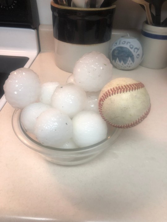
When there’s an active jet stream over a region primed for thunderstorms, it is like adding gasoline to a fire. It forces the upper portion of a thunderstorm between 20,000 and 40,000 feet to push away from the base of the storm near the ground. This process is called, “upper level evacuation”, named for the vacuum effect it creates, forcing air from below near the ground to rise up even faster as it rushes toward the lower pressure aloft. Inside the storm, this manifests as violent updrafts which make the storm structure even more amazing with vivid cloud formations as cumulonimbus clouds go into overdrive. It also lofts raindrops high into the sky, producing hail. As these updrafts increase in strength, the hail stones can grow to greater than baseball size.

What the jet stream does for tornadoes
The jet stream winds pulling air up from the ground also give it the raw power to accelerate said updrafts into rotating columns of air that can blow at over 200 mph. Of course, I’m talking about tornadoes and in the eastern plains of Colorado and in Kansas over the past few days, we’ve become all too familiar.
This tweet from Limon Sheriff serves a vivid illustration of just how efficient the jet stream can be at pulling air high into a cloud, spinning into a vortex.
The jet stream’s impact on our upcoming forecast
While we’ll catch a calm section of air, with the jet stream staying safely away across Colorado Tuesday resulting in quiet weather, we face another surge of jet stream energy Wednesday. As predictable as the effects of lighter fluid to a backyard grill, storms could become severe in portions of eastern Colorado and in the plains of Kansas and Nebraska.

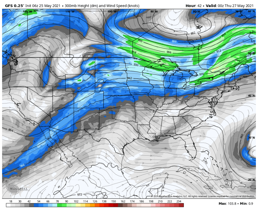
The above image details the forecast orientation of the jet stream Wednesday afternoon. This features a jet stream max over northwest Colorado, which could enhance the storm risk for the High Country.
While thunderstorms are more common on a day-to-day bases in other parts of the country like Florida, where you can often set your watch to the first clap of thunder from the afternoon summertime storms, the jet stream generally stays hundreds of miles north of that region during the summer months. A stormy atmosphere devoid of jet stream energy can still support huge rainmakers with vivid lightning, occasional hail between the size of dime and a quarter, and even some brief wind gusts as a convective cloud collapses as the storm pulses down to it end. But the hours-long tornado-makers and giant-hail producing monsters of the Midwest stay far to the north in the vicinity of the jet stream. In those southern regions, the worst severe weather often happens in winter, when the jet stream finally dips over the Gulf of Mexico as arctic air plunges southward.
Next time you see that ‘ol jet stream map on the weather forecast during our storms season, now you know without even hearing it, that severe weather could result. Then, it’s just a matter of how bad, and the relationships is direct in the strongest the jet, the stronger the storms. In a way, we’re all jetsetters as everything moves faster with the jet stream!

