DENVER (KDVR) — Update (11:45 a.m.): The National Weather Service has issued a severe thunderstorm watch for several counties around Denver and into the eastern plains.
This watch is in effect until 7 p.m.
This alert was posted at 11:40 a.m., and is the second severe notification today. At 2:42 a.m. today in Yuma County near the Kansas border as severe storm warning was issued.
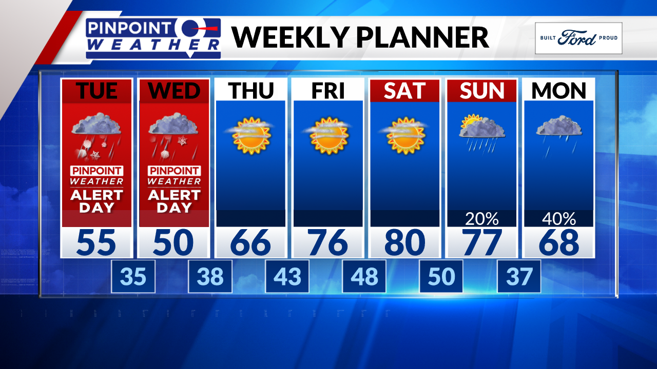
Original (6 a.m.): We’re in for a wild 24 hours with rain, t-storms, snow, hail, sleet, and possibly thundersnow.
We are forecasting a dry start to Tuesday then rain showers develop around lunch in Denver and across the Front Range. T-storms will follow.
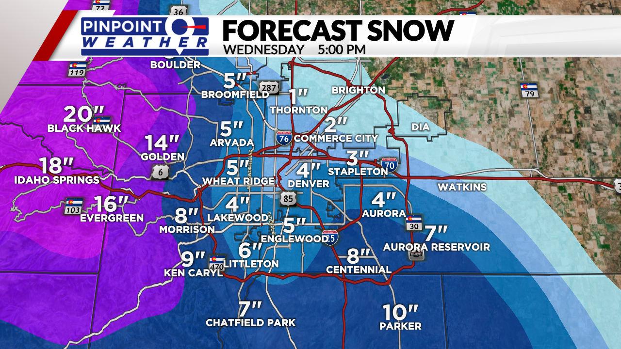
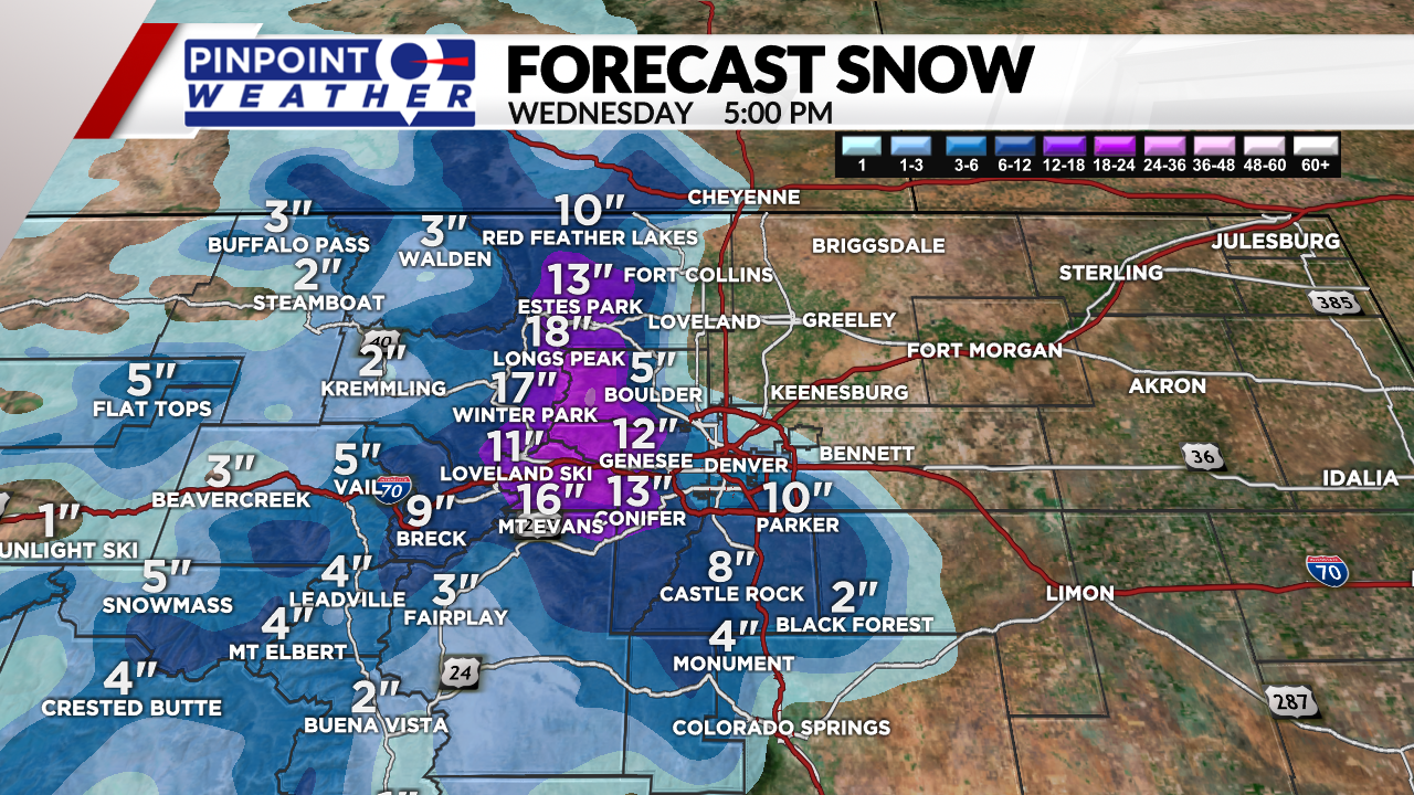
The Foothills can expect a rain/snow mix over to all snow midday, afternoon and tonight. 1-2 feet of heavy wet snow. Watch your trees carefully.
The Palmer Divide starts as rain then goes to a rain/snow mix then to all snow. 4-10 inches of heavy wet snow possible above 6,000ft.
The mountains west of the Divide can expect rain/snow to all snow today. 3-8 inches of total accumulation by Wednesday morning.
The prime window for a rain/snow mix in Denver is 8 p.m. through 4 a.m. We could accumulate 1-4 inches of snow in Denver with lots of melting. This storm tapers-off after the morning rush hour on Wednesday.
Drier and much warmer Thursday-Sunday with highs 75-80.


