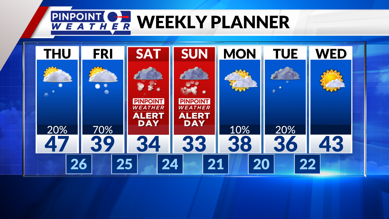
DENVER (KDVR) — The weekend snowstorm is still on track. We are forecasting some sunshine, followed by a 20% chance of a rain or snow shower in Denver and across the Front Range. Highs will be in the 40s.
The mountains start dry then snow showers develop. Expect one to two inches of accumulation.
A cold front arrives on Friday with on and off snow showers in Denver. Expect one to two inches west of Interstate 25 and into the Foothills.
The main storm system arrives Saturday and Sunday. The window for heaviest snow is Saturday afternoon into Sunday morning. Snow tapers-off by Sunday night. It’s possible rain mixes in with the snow near DIA and across the Eastern Plains. It could change to all rain over parts of the Eastern Plains cutting down on total accumulations.
Grand totals of 1-2 feet in Denver and across I-25. 2-6 feet in the Foothills (above 6,000ft). See forecast maps below.
Calmer by Monday with a few lingering snow showers early.


