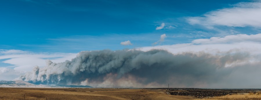
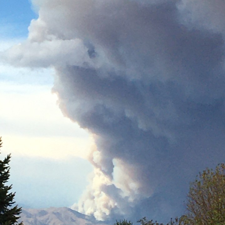
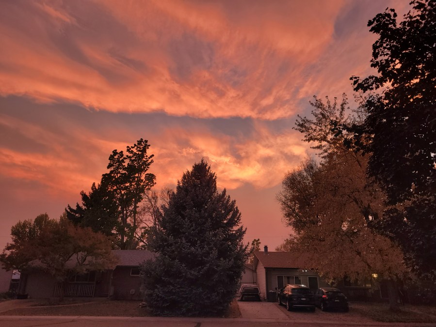
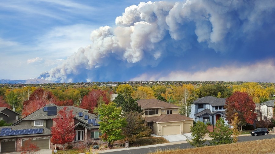
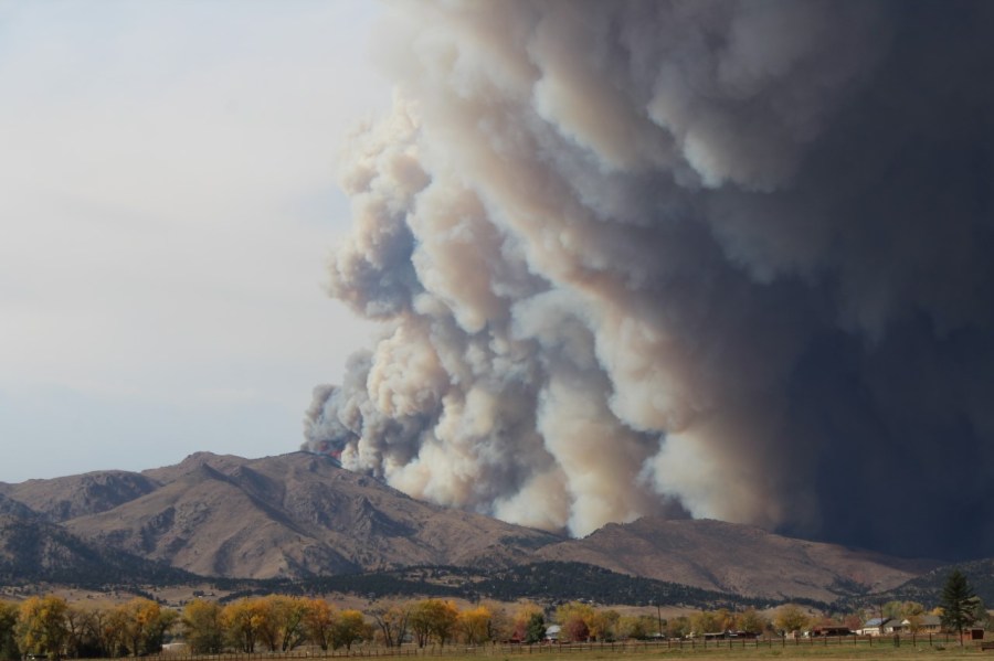
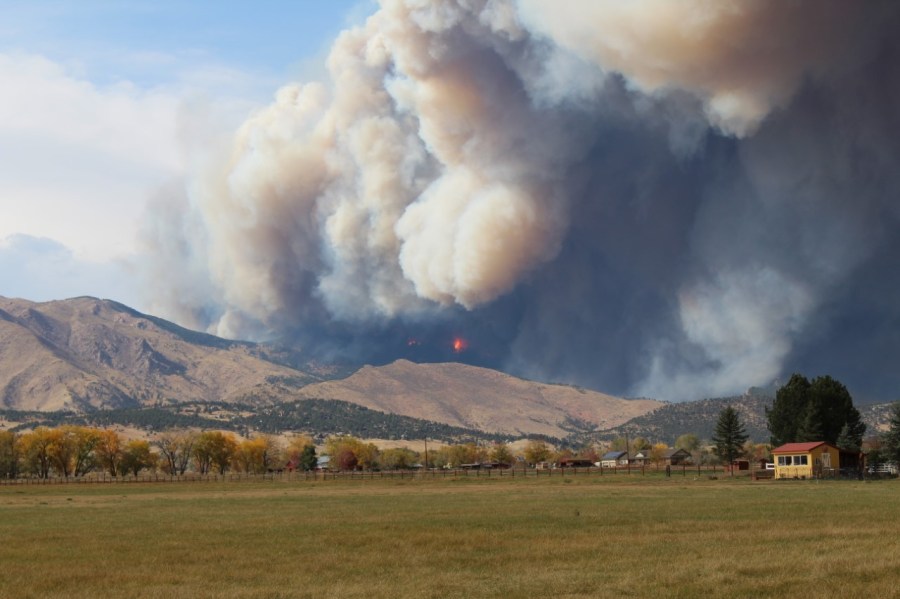
BOULDER COUNTY, Colo. (KDVR) — Crews responded to a new wildfire burning northwest of Boulder midday Saturday, Oct. 17.
Find the latest updates on the wildfire below:
UPDATE (Nov. 14, 8 p.m.): Officials reported the CalWood Fire is 100% contained. Authorities will continue to monitor the area daily.
UPDATE (Nov. 5, 1:30 a.m.): Crews who flew over the fire report only two hotspots remain. They are both on the north side of the fire in rugged terrain.
“The helicopter assisted firefighters with waterdrops again (Wednesday). On the contained south side of the fire, progress on suppression repair continued,” officials said.
UPDATE (Nov. 4, 4:04 p.m.): Firefighters continued their mop-up work today on the uncontained north side of the fire along Highway 7. They also worked on the contained south side, continuing their suppression repair work. Winds are expected to increase at 7-10 mph with gusts up to 20 mph. Temperatures are expected in the low 60s and relative humidity in the 30s.
UPDATE (Nov. 3, 7:17 p.m.): Firefighters had success today mopping up isolated hotspots on the north side of the #Calwood Fire. The helicopter assisted with water drops. The fire remains at 76% contained and did not increase in size. Firefighters also worked with heavy equipment to continue suppression repair on the south side of the fire. An engine crew will remain on the fire until late this evening. Tomorrow winds are expected to increase at 7-10 mph with gusts up to 20 mph. Temperatures are expected in the low 60s and relative humidity in the 30s.
UPDATE (Nov. 1, 11:22 a.m.): Warmer temperatures and low humidity are expected today. Most of the snow has melted in the fire area. Some smoke may be visible today. Firefighters will use information from yesterday’s MMA flight and continue to mop-up isolated hot spots and work to further secure firelines using aircraft as needed. They will be working their way into the uncontained portion of the fire area where it is safe to do so. Firefighters will also continue suppression repair work to minimize potential soil erosion and impacts from fire suppression activities on some of the contained portions of the fire.
Watch out for firefighters and fire equipment that will be working around the fire area and along Highway 7.
UPDATE (Oct. 31, 9:52 p.m.): The fire remains 76% contained with no increase in size. There was low fire activity and firefighters continued to make good progress cooling hotspots and were assisted as needed by water drops from a helicopter.
Firefighters were also able to start repair work on suppression areas around some of the contained portions of the fire. An engine crew will remain on the fire until late this evening.
UPDATE (Oct. 31, 11:04 a.m.): There was no reported fire activity overnight despite windy conditions, officials said.
A flight crew identified hot spots this morning.
“Firefighters will use that information to continue to mop-up isolated hot spots and work to further secure firelines using aircraft as needed. Yesterday firefighters were successful in mopping up most of the heat on the south and east portions of the fire. Today they will continue to use the helicopter to help cool any hotspots on the uncontained northside of the fire along Highway 7,” officials said in an update.
Estimated containment remains at 76%.
UPDATE (Oct. 29, 1:05 p.m.): Staffing for the fire today includes seven engines, two 10-person attack modules and a helicopter. Firefighters are using infrared mapping to develop a strategy to handle hit spots within the existing perimeter.
Smoke may be visible today as hot spots burn through the snow and dry out then ignite ground-level fuels.
UPDATE (Oct. 28, 11:05 a.m.): Snow has helped keep fire activity down, but as it melts warm spots could ignite. Incident commanders said smoke will be visible through the day and flames may be visible at night as unburned spots within the fire perimeter dry out.
Tonight, the Rocky Mountain Incident Management Team will hand over command of the fire to a group comprised of the Arapahoe and Roosevelt National Forests and Boulder County Sheriff’s Office Fire Management.
The fire currently sits at 10,105 acres and 76% containment. This is expected to be the final full update unless significant changes occur on the grounds.
UPDATE (Oct. 26, 10:50 p.m.): Officials said the snow and extremely cold weather, along with treacherous road conditions made it difficult for crews to get back on the CalWood Fire today.
Officials were able to get a look at the fire area to gauge conditions and figure out when firefighters could return.
UPDATE (Oct. 26, 10 a.m.): Up to 13″ of snow fell on the CalWood fire Sunday into Monday in the higher elevations, which helped drop down the fire’s heat and smoke levels.
Fire activity is expected to be greatly diminished, but firefighters will continue to monitor for hot spots. Once conditions clear up, crews will begin working to expand beyond the current 76% containment.
One method that crews will be utilizing for mop up is called “cold trailing.” Cold trailing is a method of removing heat from the edge of the fire by carefully inspecting and feeling areas on the ground with the back of a bare hand. If heat is detected, firefighters then use hand tools to dig out those areas to the release heat and add water to cool the area.
UPDATE (Oct. 25, 11:25 p.m.): Up to 11 inches of snow fell over the CalWood fire today. Freezing drizzle and slick treacherous roads made travel extremely dangerous for fire equipment. Fire personnel took the day to rehab equipment and get ready to go if conditions allowed.
The fire is 76% contained and is 10,105 acres.
UPDATE (Oct. 24, 11:37 p.m.): Firefighters continued building fireline on the south side of the fire between the Baralat Education Center and Spruce Gulch. The CalWood Fire is 76% contained and is burning 10,095 acres.
UPDATE (Oct. 24, 10:06 a.m.): Crews were able to strengthen containment along the southern edge of the fire yesterday. Containment remains at 66%. Strong winds will challenge firefighters today.
“Priorities will be to focus on increasing containment by improving and mopping up lines around most of the fire’s edge. As the fire backs down towards Highway 7, firefighters are patrolling and improving lines along contained portions of the perimeter. Crews are scouting for opportunities to construct fire lines to prevent the fire’s spread up or down the South St. Vrain canyon,” officials said in an update.
UPDATE (Oct. 23, 9:52 p.m.): The fire is now 66% contained. Its size remains at 10,073 acres.
UPDATE (Oct. 23, 11:15 a.m.): Firefighters are working today to build off containment gains made yesterday when a cold front moved in and brought light precipitation.
In the South St. Vrain Canyon, the fire is backing down toward Highway 7 and is being monitored by the incident management team. Other firefighters in that area will be working to ensure it doesn’t change direction or begin spreading beyond where it exists.
UPDATE (Oct. 23, 12:17 a.m.): Crews worked east and west towards each other improving and mopping up containment lines on the south side of the fire. On the north edge of the fire, crews patrolled and mopped up lines that were accessible.
In the steeper terrain in the western end, crews monitored as the fire slowly worked its way down the canyon towards Highway 7.
UPDATE (Oct. 22, 3:18 p.m.): Changes to current evacuation orders have just been posted for the CalWood and Lefthand Canyon Fires, including lifted orders and re-entry allowances. See map below:
UPDATE (Oct. 22, 9:05 a.m.): The CalWood Fire is now 24% contained.
Yesterday, ground crews on the southeast edge conducted a successful burn operation near the Balarat Education Center to protect structures in that area and connected construction lines.
Firefighters are continuing to work the north side of the fire along Highway 7 to construct direct lines.
Overnight, crews were able to hold the fire to minimal growth.
UPDATE (Oct. 21, 3:40 p.m.): No escorted visits will be allowed to evacuated homes today, the Boulder Office of Emergency Management said.
Resources are currently being dedicated to the evacuation of Lyons Park Estates amid challenging firefighting conditions, including strong winds.
“We will assist residents to make these home visits as soon as the weather and resources allow, possibly tomorrow,” the office said.
UPDATE (Oct. 21, 12:15 p.m.): Due to fire behavior seen on the #CalWoodFire and the forecasted wind event for the overnight hours @BldrCOSheriff is issuing an evacuation order for Lyons Park Estates to allow residents time to safely evacuate and prevent any evacuations being needed in the middle of the night.
UPDATE (Oct. 21, 11:35 a.m.): Boulder County Emergency Management: “We know it’s important for residents to be able to return to certain neighborhoods to retrieve items and shut off water (protect pipes), but we cannot allow it at this time. Conditions are still not safe enough. We appreciate your patience.”
UPDATE (Oct. 21, 9:05 a.m.): Today, crews fighting the CalWood Fire are planning to use dozers and other heavy equipment to work on the southeast side of the fire building containment lines.
On the southwestern side of the fire, crews will continue tactical operations to connect a series of existing control lines and protect properties in the Balarat area.
UPDATE (Oct. 21, 7:30 a.m.): As of Wednesday morning the CalWood fire has now burned 9,915 acres. It is 21 percent contained.
UPDATE (Oct. 20, 9:51 p.m.): Firefighting officials said six people remain unaccounted for, but it’s still unclear whether they were in the area at the time of the fire.
Authorities said they are putting together a plan to allow residents to re-enter the area, but that will likely not happen tomorrow.
The Boulder County Sheriff’s Office said tomorrow’s weather will contribute to active fire conditions, and therefore is “not going to be conducive to re-entry.”
UPDATE (Oct. 20, 7:44 p.m.): The fire has grown to 9,365 acres — an increase of about 260 compared to last night’s estimate. Containment remains at 17%.
UPDATE (Oct. 20, 10:30 a.m.): Air support was used extensively at the CalWood Fire Monday, especially along the fire’s northern edge. Also on the northern edge, crews monitored and mopped up spot fires that flared up.
On the southern edge, crews are working on line construction from east to west with the goal of connecting the burned areas and lighter fuels into the 2003 Overland Fire burn scar.
UPDATE (Oct. 20, 9:30 a.m.): CalWood and Left Hand Canyon Fire Virtual Community Meeting tonight at 7:30 p.m. ow.ly/eo3650BXDDl. You do not need a Facebook account to view the meeting.
UPDATE (Oct. 20, 7 a.m.): Boulder County evacuation points will reopen at 8 a.m. on Tuesday morning.
Evacuation Points:
- Nederland Community Center – 750 CO Highway 72, Nederland
- Boulder County Iris Center – 1333 Iris, Boulder
For any sheltering needs after hours, please contact the Red Cross at 1-800-417-0495, option 1.
UPDATE (Oct. 19, 11:02 p.m.): The CalWood Fire is burning 9,106 acres with 17% containment.
“The use of aerial assets was effective on both fires today as winds were diminished from the past two days. Higher elevation winds are expected at times over the next two days with the highest wind gusts of 35-45 mph occurring overnight tonight above 8000 feet. Engines will be out working on both fires throughout the night,” officials posted on inciweb.
UPDATE (Oct. 19, 6:01 p.m.): The Boulder Office of Emergency Management reports the Damage Assessment Team got to almost all remaining homes and report no new losses. The far western section is still too dangerous and active for the team to reach.
UPDATE (Oct. 19, 11:35 a.m.): Thanks to an inversion on Sunday, weather prevented the CalWood Fire from having any measurable growth.
Today, crews will continue fire line construction to protect structures and gain a higher level of containment.
Unlike most of yesterday, aircraft will be able to fly today to assist with water and retardant.
Crews on the east side of the fire will be mopping up and securing lines near Highway 36.
UPDATE (Oct. 19, 7:30 a.m.): SkyFOX is flew over the CalWood Fire Monday morning. Rubble was spotted from near Nelson Road and US-36.
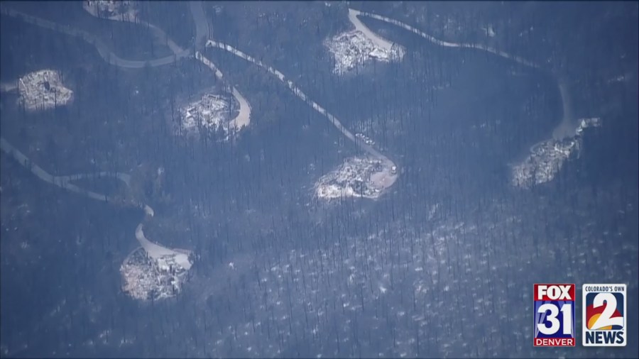
UPDATE (Oct. 18, 7:30 p.m.): In an update from Boulder County Division Chief Mike Wagner, there was little growth in the fire today and containment remains at 15%. He said it is the largest fire in Boulder County history.
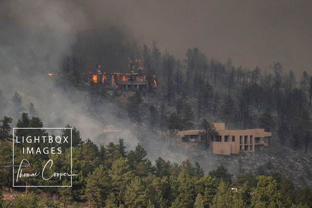
The damage assessment team (DAT) reported 26 structures have been lost on the eastern side of the fire with no additional lost today. Wagner did say there are probably more structures that have been lost that the DAT could not reach due to safety reasons.
A joint investigation into the cause of the fire between the Forest Service and the Boulder County Sheriff’s Office is underway, Wagner said.
UPDATE (Oct. 18, 5:54 p.m.): Officials report the containment of the fire is up to 15%.
The public call center (303-413-7730) for non-emergency questions regarding the Cal-Wood or Lefthand Canyon Fires will be open until 10 p.m. tonight and re-open tomorrow at 8 a.m.
UPDATE (Oct. 18, 4:31 p.m.): The latest map from Boulder OEM shows the location of the fire and the areas of mandatory and voluntary evacuations.
UPDATE (Oct. 18, 12:45 p.m.): Fire officials are providing a live update on the Cal-Wood fire. Watch below.
There are about 250 individuals involved in fighting the fire on the ground. According to incident managers this is the largest wildfire in Boulder County history.
The investigation into the cause of the fire is a joint investigation between the Boulder County Sheriff’s Office and the National Forest Service.
UPDATE (Oct. 18, 9:05 a.m.): The Cal-Wood fire currently stands at just over 7,000 acres. Fire crews from multiple jurisdictions are working together to contain it and protect structures in its path.
In addition to yesterday’s road closures, Overland has been closed at Peak to Peak.
UPDATE (Oct. 18, 8:25 a.m.): Poudre Valley REA said it’s closely monitoring both fires in the area today and tweeted a picture taken overnight from Longmont showing the flames of the Cal-Wood Fire.
WestMetro fire also tweeted pictures taken overnight. These photos show fire crews working along roads in neighborhoods west of Highway 36.
UPDATE (Oct. 17, 10:25 p.m.): The City of Longmont has closed Button Rock Preserve thru Sunday due to the Cal-Wood Fire. The Preserve is seven miles west of Lyons on BC Road 80. The city will notify the public if the closure is extended.
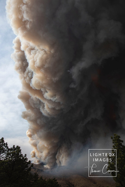
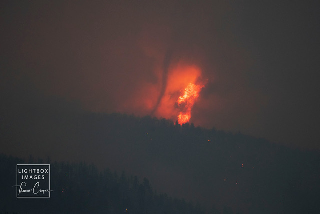
UPDATE (Oct. 17, 10:18 p.m.): A professional photographer, Thomas Cooper, captured the fire throughout the day. Check out this slideshow.
UPDATE (Oct. 17, 9:30 p.m.): Boulder County Sheriff’s Office provided an update on the fire and answered questions from the media.
BCSO says there are structures that have been damaged or lost but they can not estimate how many or exact location as they are assuming by fire behavior and movement.
An official says natural causes have been ruled out for the spark of the fire but it is still too early to determine exact cause.
UPDATE (Oct. 17, 9:02 p.m.): The evacuation center at Broadway and Iris in Boulder has been closed for the night. It will reopen at 9 a.m. on Sunday. As well, the update hotline will close at 10 p.m. and reopen at 8 a.m.
UPDATE (Oct. 17, 8:22 p.m.): According to the Boulder OEM, the fire is estimated at 7,064 acres.
UPDATE (Oct. 17, 7:38 p.m.): All evacuation orders east of N. Foothills Highway have been lifted. Town of Lyons residents, including those on Apple Valley Road up to Highway 36, are being advised to be prepared to evacuate in case the fire behavior changes tomorrow.
UPDATE (Oct. 17, 6:56 p.m.): The phone number for an emergency call center that has been set up is 303-413-7730. This number is for non-emergency questions about the fire. Officials as to please keep 911 for emergency calls only.
FOX31’s Jim Hooley is in Boulder with nighttime footage of the fire.
UPDATE (Oct. 17, 6:35 p.m.): According to the Boulder Office of Emergency Management, about 900 homes are in the evacuation area and only four residents need shelter for the night of those who have checked into the North Broadway Complex evacuation center.
UPDATE (Oct. 17, 5:15 p.m.): Check out the interactive evacuation map issued by Boulder County.
UPDATE (Oct. 17, 4:40 p.m.): Livestock (horses, cows, sheep, chickens, pigs, etc.) and pets can be sheltered at the Boulder County Fairgrounds, 9595 Nelson Rd, Longmont.
Pets (cats, dogs, etc.) can go with you to evacuation point at Iris/Broadway or to the Boulder Valley Humane Society, 2323 55th St, Boulder.
UPDATE (Oct. 17, 3:56 p.m.): Road closures due to Cal Wood Fire:
- Overland @ CR 87
- Overland @ Peak To Peak
- Lefthand Canyon @ James Canyon
- Peak To Peak @ Hwy 7
- South St. Vrain @ Old South St. Vrain
- Lefthand Canyon & Hwy 36
- Hwy 36 @ Hwy 66
- Olde Stage @ Lee Hill
- Lee Hill @ Lefthand Canyon
- Broadway @ Hwy 36
- Neva @ Hwy 36
- Nelson @ Hwy 36
- St. Vrain @ Hwy 36
- Hygiene Rd @ Hwy 36
UPDATE (Oct. 17, 3:13 p.m.): There is an evacuation check-in point set up at 3460 N. Broadway – Boulder County’s North Broadway Complex at Broadway and Iris. Evacuees and pets can go there to check in and receive further information.
The fire has crossed over the final ridge before descending into the plains. It now appears to be near homes just west of Altona, up on the hill. This is about 5 miles north of Boulder.
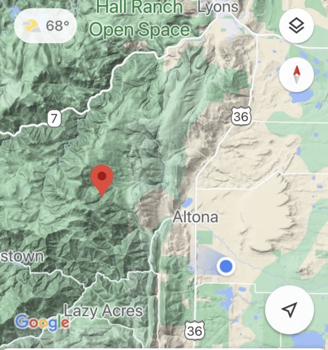
At 12:45 p.m., the Boulder County Sheriff’s Office said the fire is located near the Cal-Wood Education Center, which is roughly 10 miles northwest of Boulder.
About 1:50 p.m., the Boulder Office of Emergency Management said the town of Jamestown is being evacuated.
According to BCSO, County Road 87 is closed due to the fire. Additionally, South Saint Vrain Drive is closed between the town of Lyons and the Peak to Peak Highway.
“Please avoid the area and give first responders room to work,” said the sheriff’s office, which referred to the blaze as the “Cal Wood Fire.”
The Hall Ranch and Heil Valley trails are also being evacuated, BSCO said.
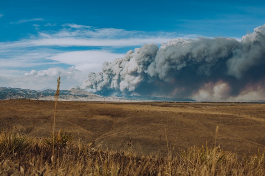
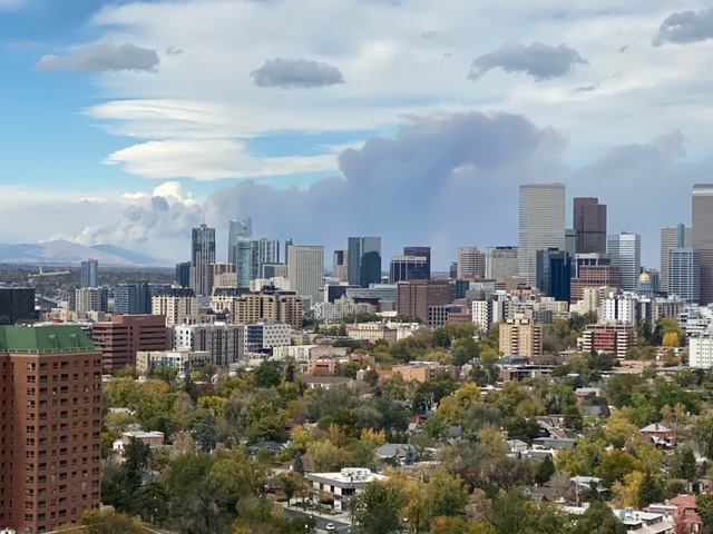
Smoke is visible from much of the Front Range, including Denver.
This is a developing story. Please check back for updates.

