DENVER — A strong winter storm will bring blizzard conditions to Denver and the eastern Plains on Wednesday with sustained wind of 50 mph for more than 12 hours.
The prime window for blizzard conditions starts at 10 a.m. and goes until midnight.
The system starts as rain in the morning but changes to snow around 9-10 a.m. as the storm system rapidly intensifies. Changeover occurs later over the eastern Plains.
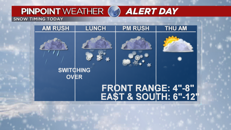
The heavy snow begins around lunchtime and lasts through the evening commute. The roads will get worse as the sun sets.
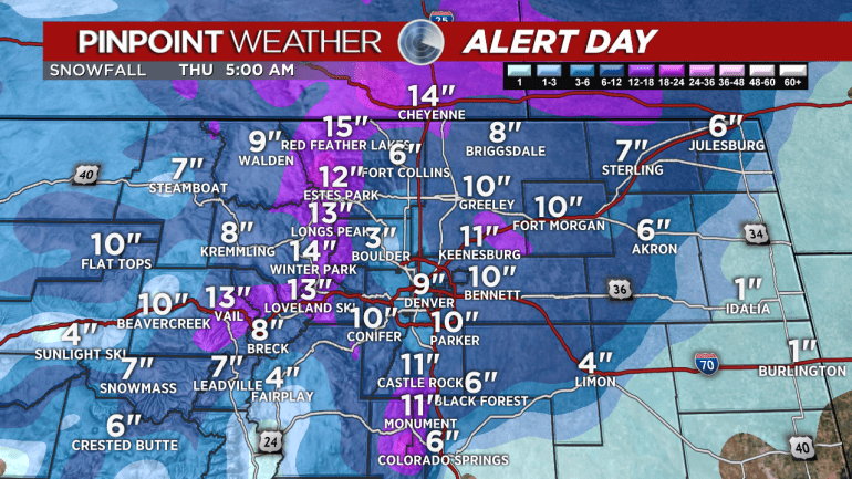
The heaviest snow accumulations and strongest wind occurs east of Interstate 25, on the eastern Plains and across the Palmer Divide.
There will be sustained winds of 50 mph-plus for 12 hours with gusts up to 100 mph possible near Limon.
Storm ends around 10 p.m. tonight across the Front Range but will last longer across the eastern Plains.
Six to 12 inches totals east of I-25, Eastern Plains, and Palmer Divide. Four to 8 inches in the western suburbs and 6-12 inches foothills and Mountains.
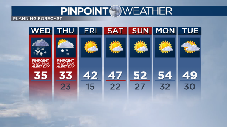
Flurries, cloudy, breezy Thursday morning with afternoon improvement.
Sunny Friday-Sunday.
Check interactive radar and zoom in to where you are. Plus, check the radar anytime with the Pinpoint Weather App for iPhone and Android.

Pinpoint Weather has been independently certified as Colorado’s Most Accurate Forecast by WeatheRate.
We’re tracking weather today on FOX31 Denver and Channel 2 News – and when conditions are bad we send out the Weather Beast.

